

SCOFrance
51Connected participants
Next quarterly22 June 2023
Theme: Agriculture
SCOlutions to hydrometeorological risks
According to a detailed report (August 2021) by the World Meteorological Organization, the number of disasters has increased fivefold in 50 years: 44% of them are associated with floods, 17% with tropical cyclones. Satellites are a considerable asset for implementing monitoring and warning systems and, in general, for covering the different phases of risk.
Three projects presented their solutions on Thursday 23 March 2023 during the 8th Quarterly Meeting of the SCO France, which you can relive in the videos below (in French). Their remarkable results were greeted by intense exchanges between the participants and are the result of an equally remarkable involvement of the project teams.
If you have any questions about this quarterly, please write to us here.
INTRODUCTION: The use of satellite data in the different phases of risk management
By Linda Tomasini, SCO referent and CNES representative for the International Charter Space and Major Disasters
To remember
- The crucial contribution of space missions is recognised for the emergency phase when a disaster occurs, with existing operational mechanisms such as the International Charter Space and Major Disasters, the Copernicus Emergency and Sentinel Asia services.
- Earth Observation is equally crucial to support the reconstruction phases in the weeks and months following a disaster. To demonstrate this effectiveness, the CEOS Working Group Disaster has been developing demonstrators of recovery obersavories for the past four years, to build back with a better resilience to a potential new disaster.

Diagram of the risk cycle and associated issues. The operational services responding to the risk cycle and the three SCO projects presented today are also positioned.
1 BanD-SOS
By Fabien Durand, oceanographer researcher at LEGOS
The BanD-SOS project merged the hazard sciences with the humanities and social sciences to implement an operational numerical prediction system for cyclonic flooding in the Bengal delta, which is densely populated and particularly exposed due to its very low topography.
To remember
- Designed to ensure the resilience of the 3 million inhabitants of the delta, the system operates in real time. Thanks to Sentinel-2 data, it accurately monitors the evolution of water levels, which have a high amplitude due to the low altitude and the tides. Forecasting probable flooding 36 to 48 hours before the arrival of a cyclone, its information enables the civil authorities to organize evacuation measures.
- BanD-SOS takes into account the exposure and vulnerability of territories. The very high-resolution mapping of the vulnerability index established by the project shows that the territories closest to the coast are not the most vulnerable.
- Currently being finalized, the platform is already operational and could be delivered to the Bengal Flood Forecasting & Warning Center (FFWC) in November 2022, before the start of the cyclone season (read our dedicated news item here).
- The platform is freely available: https://bandsos.github.io
- The toolkit is also made public: https://github.com/jamal919/pyIntertidalDEM
2 Viet-ARRO
By Stéphane Mermoz, founder of GlobEO
Developed in partnership with the Vietnamese space agency VAST, the VietSCO project has two components: Vimesco-Rice, to study the impact of drought, subsidence and salt water intrusion on rice crops, and Viet-ARRO, which focuses on the impacts of typhoons and rainfall flooding on rice cultivation.
To remember
- The visualization platform offers multiple maps: seasonal rice maps, number of crops per year, flood maps and interannual variations of flooded areas...
- All these maps are derived from the automatic processing of mainly Sentinel-1 radar data.
- The system also provides projections of rice crops with saltwater intrusion. According to the simulated climate scenarios, rice cannot be grown in the Mekong Delta in 2050.
- The system is transferable to other locations. The project team is currently working with Thailand, which is particularly interested in having such a system.
- The tool is online and accessible to all: https://www.vietsco.org
3 Gade Lapli
By Julien Lamouret, engineer at Predict Service
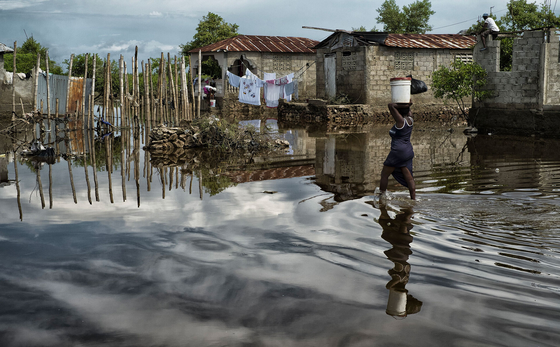
Regularly affected by extreme hydrometeorological events, the frequency of which is increasing, Haiti has little data to build up indicators of climate change and adaptation tools, which is what the Gade Lapli project proposes thanks to satellite data.
To remember
- Designed to provide assistance in managing extreme hydrometeorological events to civil security teams in Haiti, the system is designed to be replicable in other territories with limited field data and measurements.
- The project uses COSPARIN (spatial contribution to flood risk analysis, COntribution du SPatial à l'Analyse du Risque INondation) data, whose satellites produce a global precipitation estimate every 30 minutes with a resolution of 5 x 5 km. Digital terrain models are also derived from satellite images.
- The web platform, which is currently being developed, is already available to local actors and allows them to visualize in a 3D environment the real-time estimation of precipitation and flood zones.
- Interfaced with the haitidata.org database, the platform offers many layers of information. It will soon integrate vulnerability elements.
- The platform is online and works by creating a user account: https://www.wiki-predict.com