

SCOFrance
PartnersCLS, IRD, Mercator Ocean, CNES
Useful linksProject page
Key wordsSargasso, coastline, forecasting, anticipation
Tackling the scourge of sargassum with SeSaM
As far back as 1492, Christopher Columbus reported the presence of brown seaweed in the Sargasso Sea, east of Florida, where it wisely remained until 2009-2010. That winter, an anomaly in the North Atlantic Oscillation (NAO), which affects the climate system in the North Atlantic Ocean, swept the seaweed out of its sea of origin. Carried by currents and prone to proliferate as temperatures rise, this algae is becoming a real calamity in the West Indies, and as far afield as the West African coast.
Because when they arrive, they invade the beaches in their millions of tones and damage the entire coastal ecosystem. As well as the visual pollution, the main problem is the decomposition of the waste, the gases from which affect people's health. The marine anoxia generated scares away all the fish in sight, and the bad smells put a stop to any desire to approach the beach, so fishing and tourism are also severely affected.
|
|
|
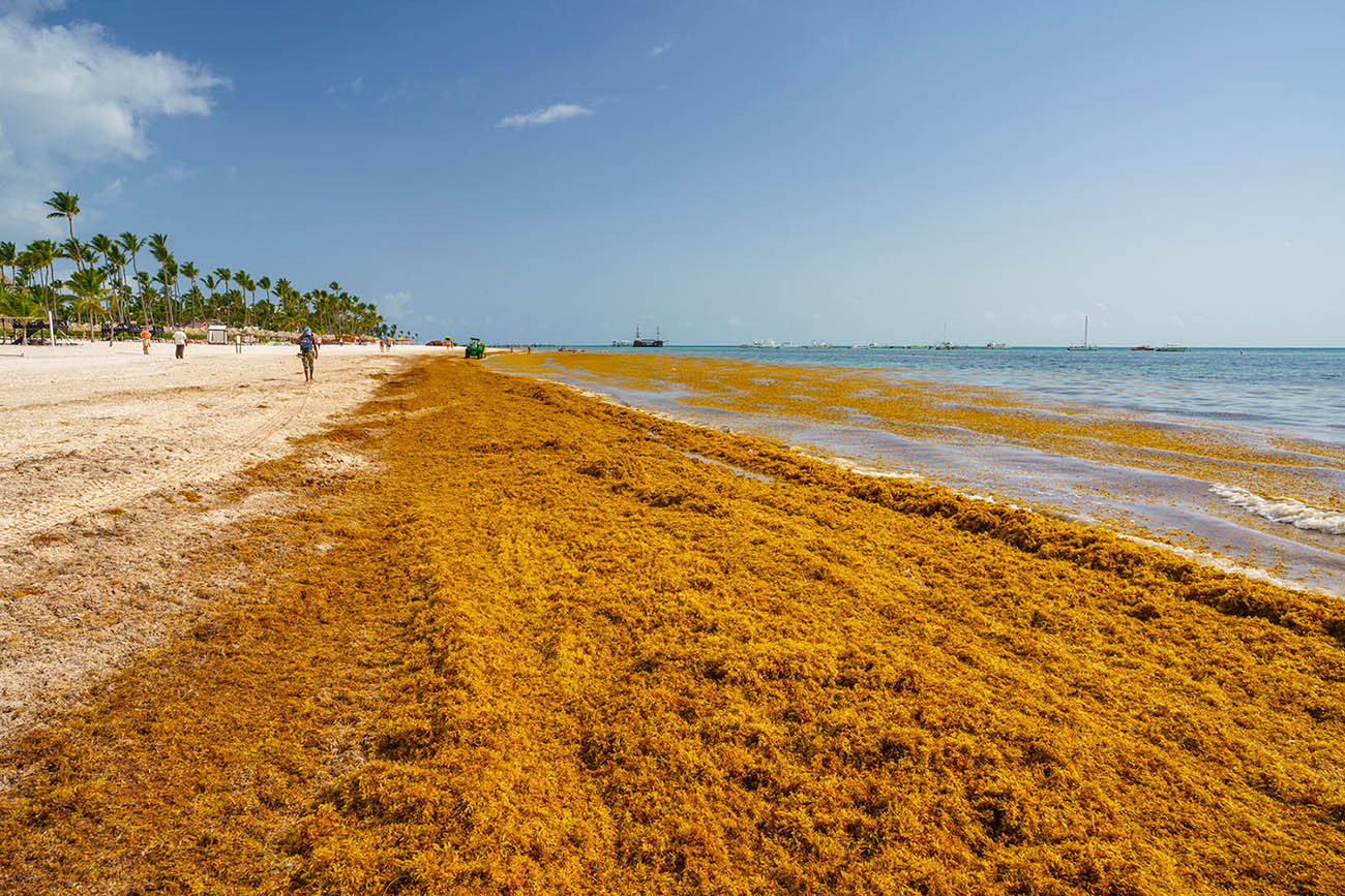

▲ Massive sargassum stranding in June 2018 on Bavaro Beach, one of the most beautiful beaches in the Dominican Republic. On the right, the invasion is such that a floating barrier has been deployed to preserve a swimming area. ©Getty Images
"The first step in providing a solution for local communities is to understand the phenomenon and monitor it in real time," says Marc Lucas, who is leading the SeSaM project for CLS.
SeSaM, a system for anticipating and acting
1: Detect and locate
|
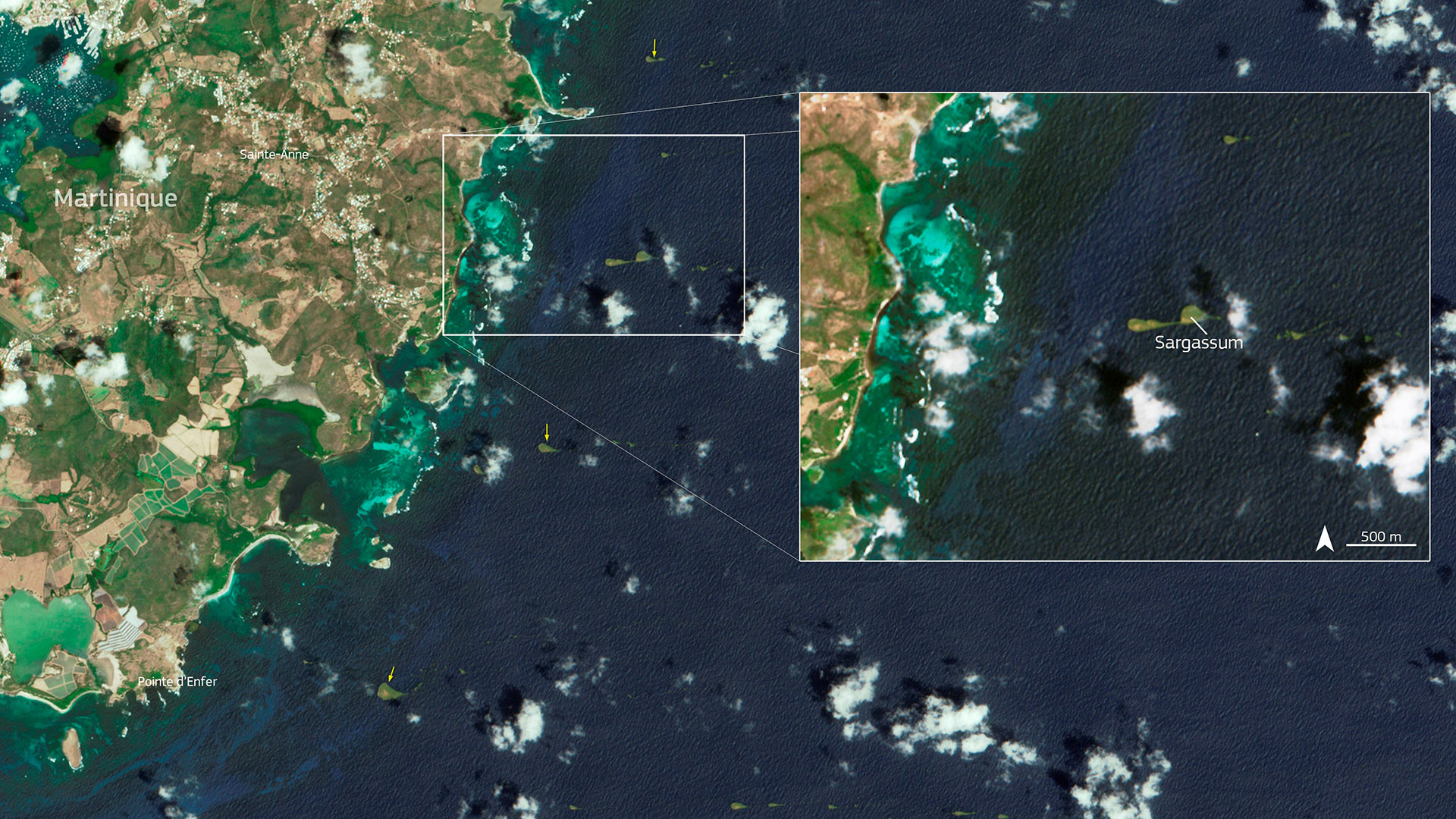
To locate sargassum in the ocean, SeSaM uses the color of the water via satellite. To achieve the required accuracy, and thanks to major Franco-American collaboration, it combines data of different resolutions, in particular Sentinel-2 and LandSat 8 & 9 at 10 and 20 meters, Sentinel-3 at 300 m and GOES at 1 km. GOES has the advantage of being geostationary, with images taken every 15 minutes, which makes up for the problem of clouds, very present in the equatorial band.
|
Detection of sargassum in the SeSaM platform. © CLS |
2: Forecast for arrival on the coast
|
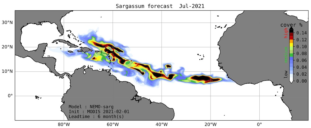
IRD has developed a sargassum growth and movement model based on remote sensing data, so that local populations and authorities can be prepared. This model now provides simulations 3 months in advance. These forecasts are used, for example, to decide when to collect the sargassum, at sea or on land, a very costly operation. |
Modelling the movement of a huge shoal of sargassum. © IRD |
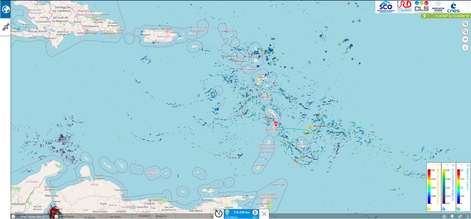
👉 To make this data accessible to the regions, the results are made available on an open-access platform.
As Marc Lucas points out, "satellites are much more effective and less costly than sending boats out to sea to locate sargassum".
 |
|
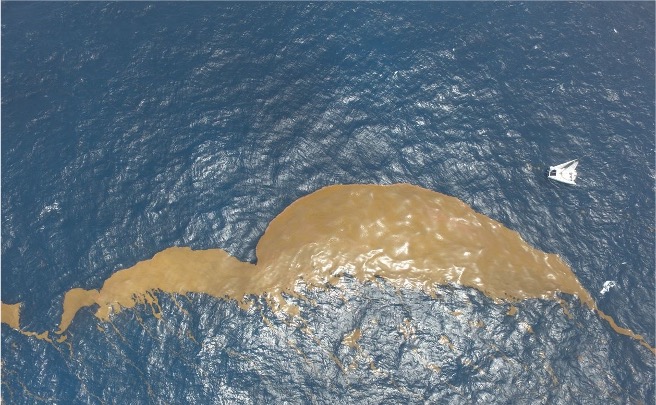
▲ To test the accuracy and precision of the locations, the SeSam team guided a boat to take measurements in situ. The sailing boat (in white on the right) arrived very precisely on the raft of sargassum located by satellites. © CLS
💡 SeSaM will present its work and a demonstration of its platform at the quarterly projects meeting on 19 June 2025. To automatically receive the invitation to the quarterly meetings, sign up HERE.
Outlook
|
With just a few months to go before the end of the project, the team is finalizing the implementation of the seasonal forecasting model, so that the forecasts can be easily accessed by users via the SeSam internet portal. |
🐠 Did you know 🌊 From 9 to 13 June 2025, the 3rd United Nations Ocean Conference (UNOC) will be held in Nice. The Space4Ocean alliance, to which the SCO is contributing, will be launched on this occasion. |