

SCOFrance
Useful linksProject page
Key wordsPolder, wetlands, restoration, dykes, salt water, sedimentation, revegetation
EO4Wetlands, a further step towards satellite-guided depoldering monitoring
Because of their role in preserving biodiversity, their unrivalled carbon sequestration capacity and their ability to reduce coastal erosion while protecting coasts from marine submersion, coastal wetlands offer nature-based approaches to mitigating and adapting to climate change and its consequences. Through their ecosystem functions and services, wetlands reduce the risks associated with sea-level rise (long-term change) and extreme weather conditions (very short-term change).
The EO4Wetlands project builds on the work initiated as part of the Polder2C's project (INTERREG) and provides an ideal opportunity to determine the methodologies for monitoring the spatial and temporal renaturation of this former polder, as well as studying the impact of climate change and extreme hydrometeorological events on the Saefthinghe wetland.
Meeting in the field
|
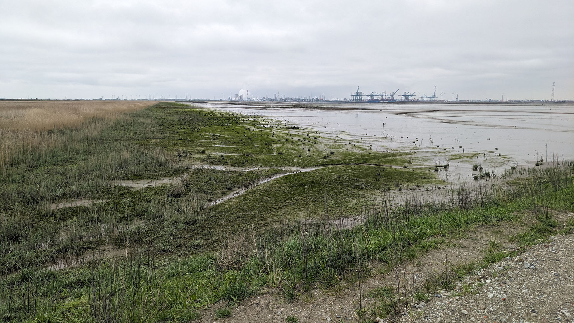
It was under a slightly cloudy and humid sky that the Cerema teams from STOWA (Dutch Foundation for Applied Water Research) and CNES met on Thursday 11 April 2024. Once through the barrier, space opens up and offers scientists unique landscapes of Zeeland Flanders, undergoing total reconstruction. The natural return of water is encouraging species specific to wetlands to reclaim the area: birds, birds of prey, rabbits, etc. The recolonization process is well under way and these observations complement the satellite images and data. |
© CNES/Célie Losada |
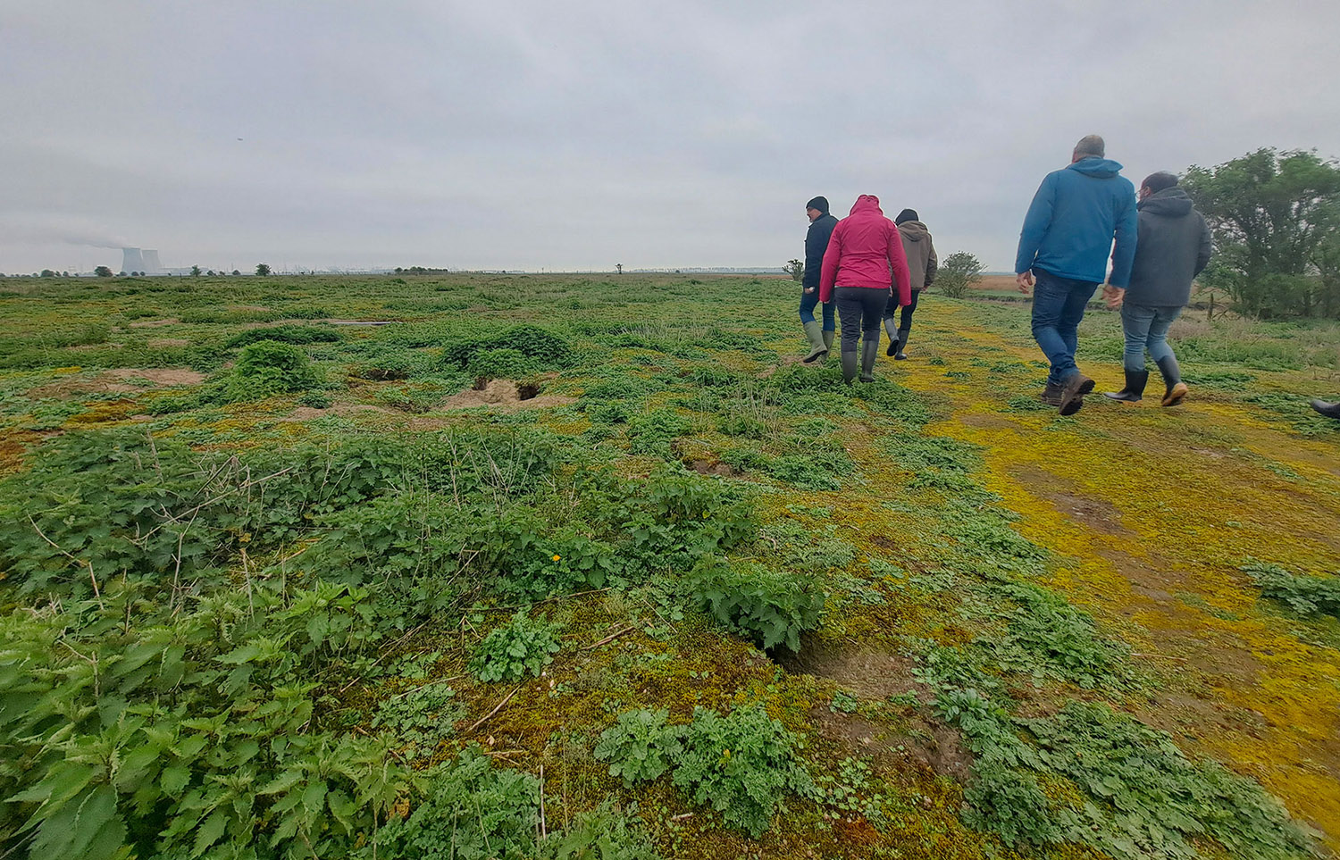
The teams are holding close discussions to co-construct tools that will improve current procedures for monitoring, mapping and characterizing wetlands. By gathering the opinions, needs and priorities of end-users, the researchers can direct their experiments towards developing combinations of data, and associated algorithms, that are relevant to the monitoring of depoldering.
|
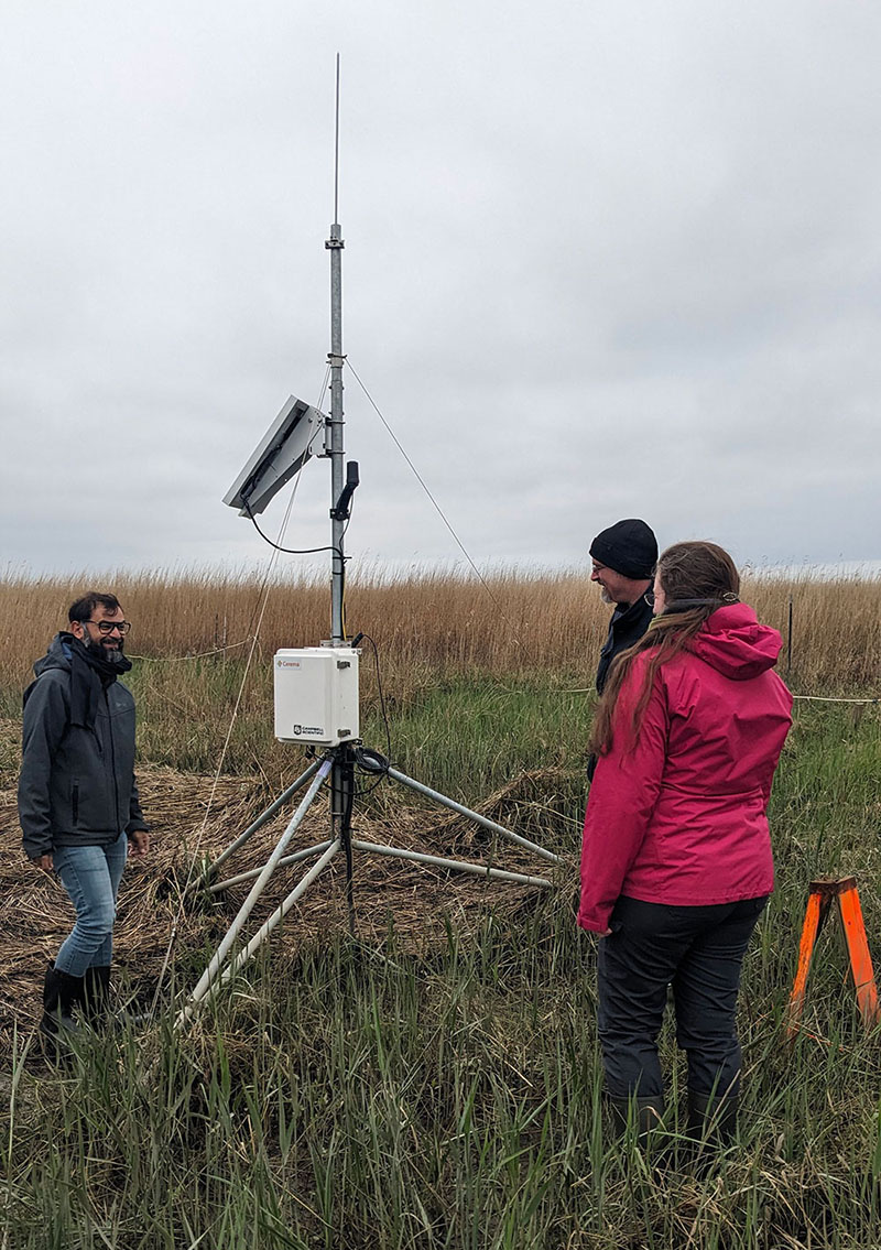
During the field visit, Cerema showed the measurement site where a probe was installed last November (read the news item 12/12/2023). The probe provides continuous monitoring of air, ground and depth temperatures, as well as water content and dielectric properties (salinity) along the soil profile, at several depth and time intervals.
►Cerema researchers (from left to right) Raphaël ANTOINE, Cyrille FAUCHARD and Teodolina LOPEZ with, in the centre, the system powering the probe. Buried under the fluorescent-orange tripod, the probe measures a wide range of physical parameters at a depth of 1 m (temperature, water content by volume, permittivity, conductivity). © Cerema/Emma Bousquet |
|
|
According to Hans van Leeuwen, head of the SAT-WATER programme at STOWA, "As this is a one-off measurement, it does not represent all the geomorphological, hydrological and ecological aspects. It is important to bear in mind that temporal measurements have the advantage of giving an overview of the general trends and dynamics of the local area". Confident about the future of the project, Hans is enthusiastic about the possible bridges of understanding with these measurements: "As these ground conditions are mainly governed by tidal processes and meteorological conditions, we expect this information to help interpret the satellite observations both directly and indirectly". And this is indeed the case! He adds: "Monitoring surface temperature, derived from satellites during tides and seasonal processes, will generally help to understand the influence of this parameter on the development of flora and fauna in space and time! And soil moisture can help to understand geophysical properties, in particular by providing indirect information on salinity, which influences soil density and texture". |
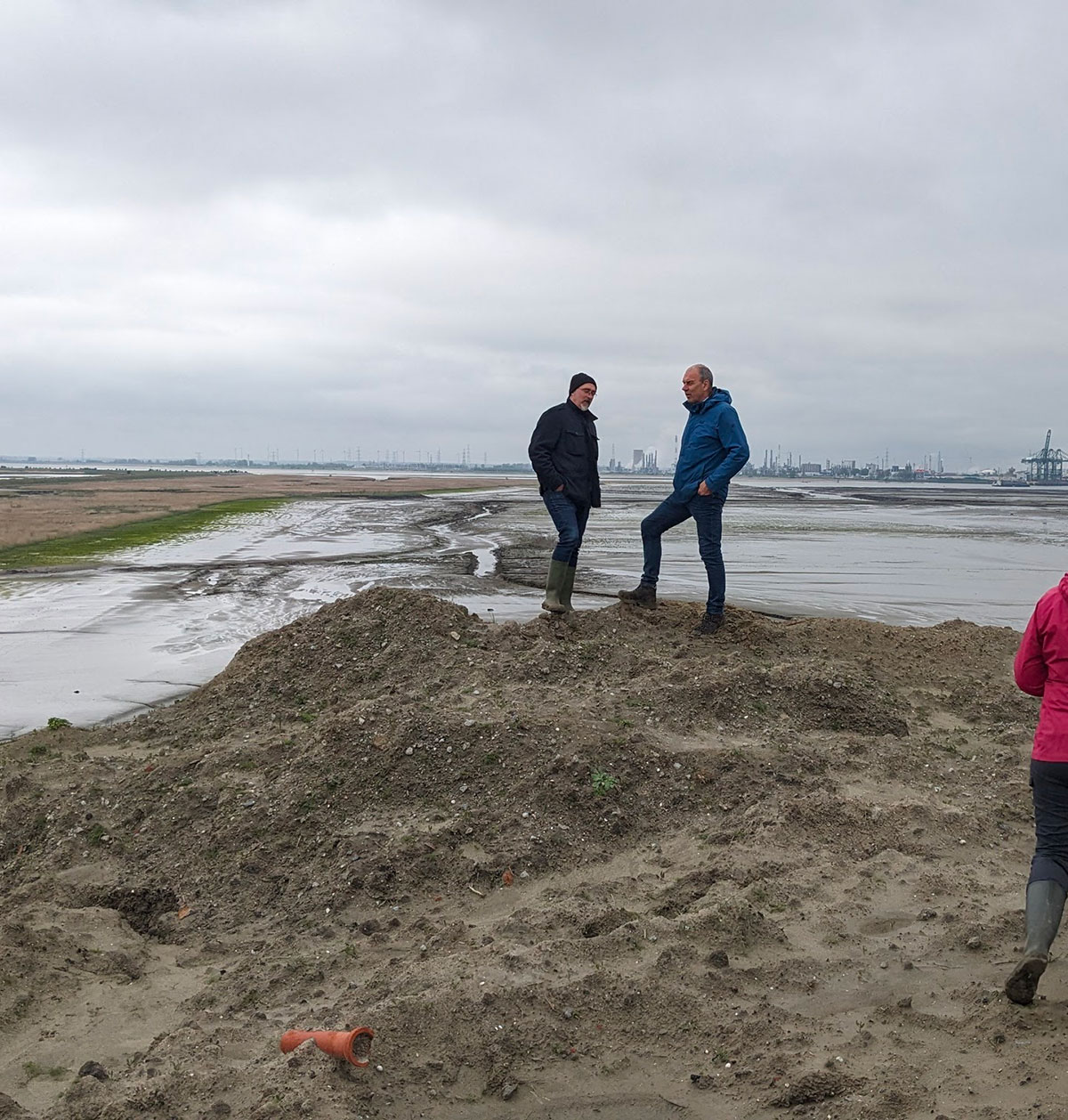
▲ Field visit to LLHPP on 11 April 2024. View of the polder being revegetated. On the left Cyrille FAUCHARD (Cerema), on the right Hans van Leeuwen (STOWA), with the port of Antwerp in the background. © Cerema/Emma Bousquet |
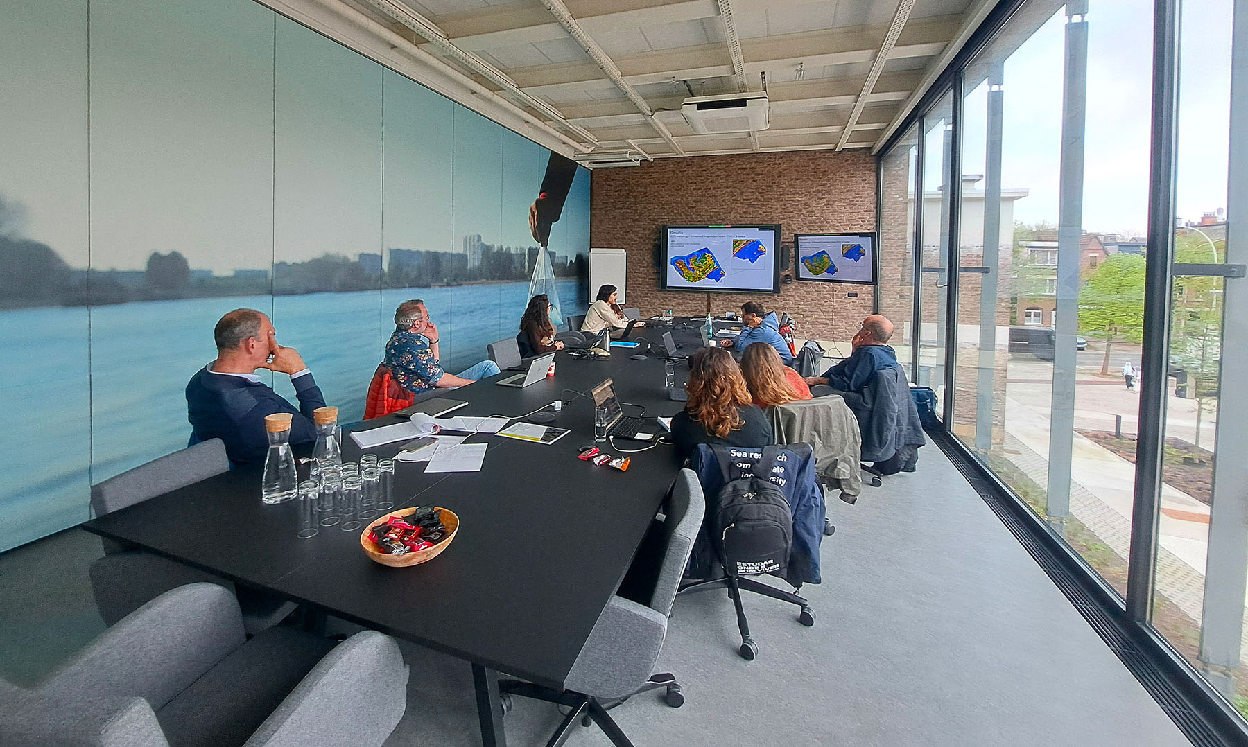
An initial steering committee meeting in Antwerp
At the end of the visit, the group crossed the border to the Flanders Hydraulics offices, where they met up with other project partners representing France Digues, Gip Seine-Aval, the University of Antwerp, the Catholic University of Leuven (KU Leuven), and the Flemish Region (Mow Vlaanderen).
|
Cerema organized this COPIL with a rich and varied programme, recalling the origins of the project and presenting the initial results obtained since its launch in June 2023.
▶︎ View of the Flanders Hydraulics room, bringing together face-to-face and distance learning participants on Thursday 11 April in the afternoon in Antwerp. © CNES/Célie Losada |
|
|
After a presentation of the SCO programme by Célie LOSADA (CNES), the Cerema teams took it in turns to present their work, demonstrating that, by calibrating satellite data and in situ measurements, it is possible to refine the results at different spatial and temporal scales and for several indicators. The expertise of Cyrille FAUCHARD (Cerema) provides a new geophysical dimension with several insights into the 3D construction of surveys and soil profiles using various geophysical methods. This approach complements hydrological and hydraulic data and can provide relevant information for water and port facility managers. In her speech, Teodolina LOPEZ (Cerema) presented the organization and distribution of tasks, the different sources of satellite data and their functions for the project. "The Saeftinghe wetland, which is located in the immediate vicinity of our study area, is considered to be stable. We use it as a proxy, a valid reference point for calibrating our measurements on the Hedwige polder," explains Teodolina. Plans to acquire new drone images to bridge the gap between field and satellite observations have proved inconclusive due to the new European regulations currently being drawn up. |
This sharing of ideas has helped to mobilize the stakeholders around the table. A doctoral student from the University of Antwerp suggested using existing drone data sets from other nearby wetlands. STOWA also proposed establishing a link with the Dutch Space Agency's satellite data portal. Finally, Rollin GIMENEZ (Cerema) presented the very interesting initial results of a generic vegetation classification approach based on Sentinel-2 satellite images and AI. The methodology developed on the basis of multispectral images enables spectral indices to be calculated on time series of different scales and pixels to be grouped according to their spectro-temporal properties, taking into account the aperiodicity of the time series generated (due to frequent cloud cover on the site). Once this first stage of automated inventories has been completed, the time has come to integrate the soil temperature, humidity and salinity data acquired. Rollin reminds us that "the salinity of the area influences the type and density of vegetation. It is therefore important to use other datasets, such as the RaDAR data (Sentinel-1) which, coupled with the field data, will provide other levels of information, vegetation indices, plant typologies and the timing of the appearance of certain plants specific to wetlands". |
Facilitating data interoperability and integration
The progress of the work and the advantages of the EXAMIND tool for building a digital twin of the polder were shared with the participants.
Pascal BROGLIE from GEOMATYS presented the successful integration of satellite and other geographical information to build a 3D landscape and 'flight simulation' of the study area. It was also discussed how the end user/stakeholders could benefit from this mode of presentation as part of this project.
All of these ideas point to a bright future for the international consortium working together on this tool for monitoring the regeneration of the former Hedwige polder, and wetlands in general.