

SCOFrance
PartnersUniversity of Rennes, CNRS, TAF, INRAe, LEHNA, PATRINAT, IPEV, CNES
Useful linkProject page
Key wordsFrench Southern Territories, Amsterdam, St Paul, natural habitats, predictive mapping, preservation, restoration
Cartovege2 : Mission Amsterdam
|
Dedicated to the French Southern Territories, Cartovege is developing a vegetation mapping tool using satellite imagery to monitor the long-term evolution of natural habitats, decide on conservation or restoration actions and then check their effectiveness. Already implemented on Crozet with Cartovege1, Cartovege2 is transposing its approach to the islands of Amsterdam and Saint-Paul, adapting it to their specific ecological and geographical features. |
Cartovege2 methodology 1- Define a typology of Amsterdam and St Paul's terrestrial habitats 2- Improving the remote sensing chain used in Cartovege1 3- Modelling habitats using very high resolution images, exploring the limits of useful spatial resolution |
As the truth in the field is essential for drawing up the initial typology and then comparing the results, Diane Espel, a post-doctoral researcher in remote sensing and ecological modelling, travelled to Amsterdam Island from October to December 2024.
Definition of a typology of habitats
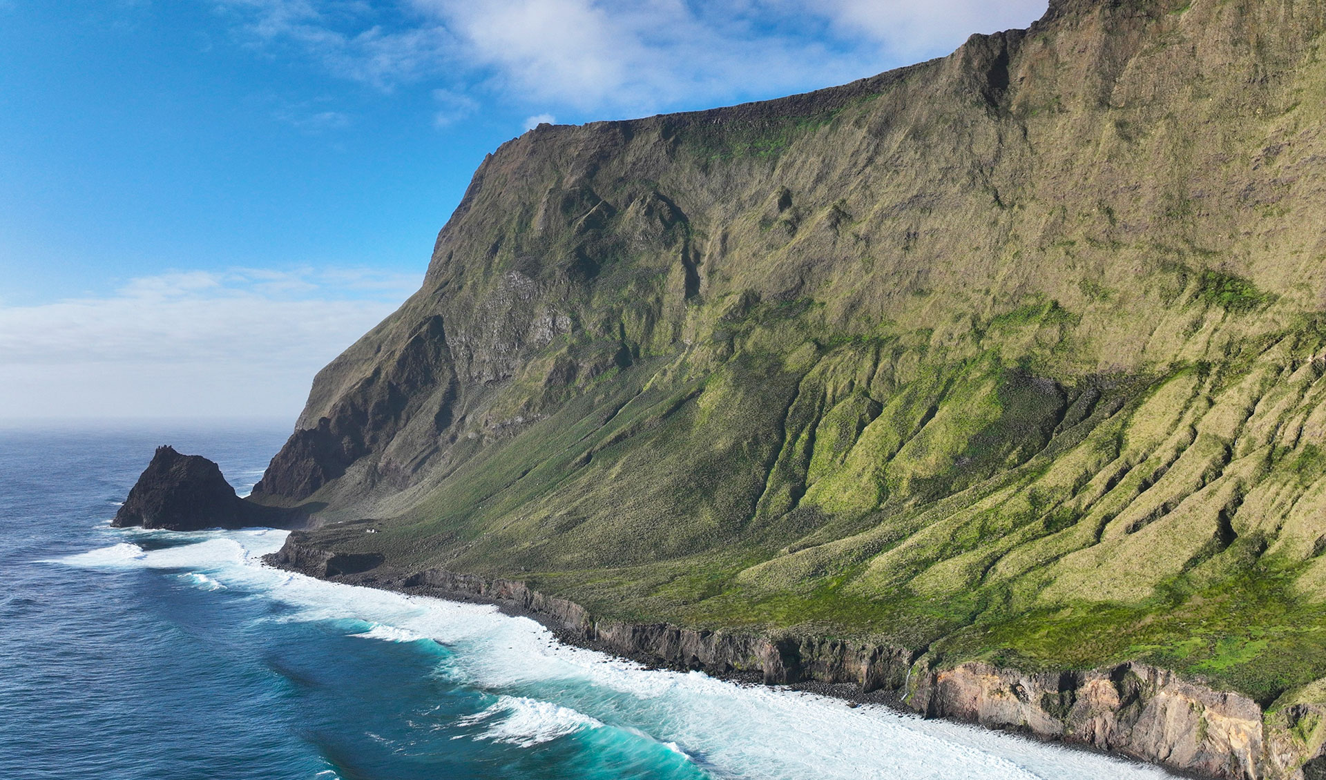
On Amsterdam, an island 54 km2 long, the vegetation is very different from that on Crozet. The subtropical climate favors the development of taller vegetation, even trees, which are sometimes difficult to penetrate, a far cry from the heaths and short sub-Antarctic grasslands of Crozet, which are battered by violent winds. The habitat typology is therefore unique to Amsterdam, and the model learnt on Crozet needs to be adjusted to take account of Amsterdam's specific floristic characteristics.
|
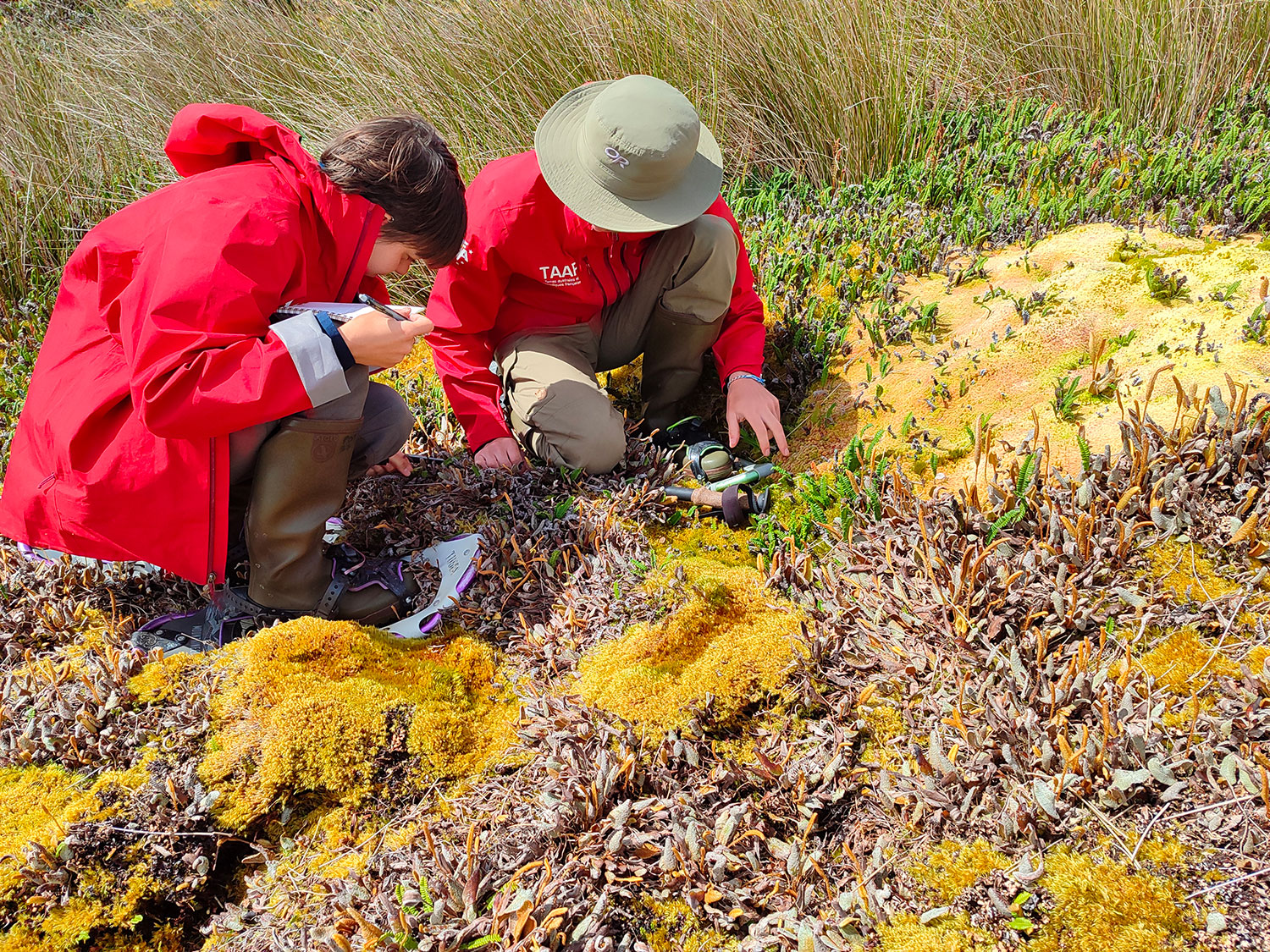
Before setting foot on the island, Diane meticulously scoured the literature and analyzed 750 floristic surveys acquired since 2016, resulting in a preliminary version of the habitat typology. In the field, this typology was refined and corrected thanks to the acquisition of new data, particularly in areas that had been little or not at all sampled. Despite the sometimes-complex exploration conditions, particularly in areas with dense, high vegetation (up to 4 m), 535 new surveys were carried out by the post-doctoral researcher and her botanist colleagues from the TAF Environment Directorate, Julie Bornes and Elzéar Hamard-Mulot, the project's partners. "The vegetation, which is highly conditioned by altitude (up to 881 m), shows a strong layering and gradient of humidity. On returning from the mission and after analysis, the typology of the vegetation was validated with 48 classes, which will shortly be described in the guide to natural habitats" relates Diane Espel. |
▲ Phytosociological surveys and identification of habitats on the Peatland plateau on Amsterdam Island for the Cartovege² team. © Diane Espel, 2024 |
Remote sensing and processing chain
The other major aspect of the project involves adapting the imaging data processing chain to meet Amsterdam's specific requirements. "We acquired Pleiades and Pleiades Neo satellite images. We added pre-processing modules, in particular to better automatically define a remotely detectable typology and integrate new variables such as texture. We have also developed indices of habitat fragmentation and condition in order to integrate a final module for the temporal monitoring of habitats in the chain to assess the evolution of habitats with introduced species", details Diane. She is now working on creating a user package, "a downloadable zip file with all the modules installed automatically to make the chain easier to use".
|
However, automatic mapping of 48 classes remains a challenge. In search of the best cost-efficiency ratio, the Cartovege team is testing the feasibility of using other very high-resolution multispectral images, in particular drone* images, to map habitats more accurately. "One of the applications of the chain is to determine the minimum spatial resolution required to detect habitats by comparing the mapping results obtained with different types of images”, explains Diane. *Read more about drone use at Cartovege
|
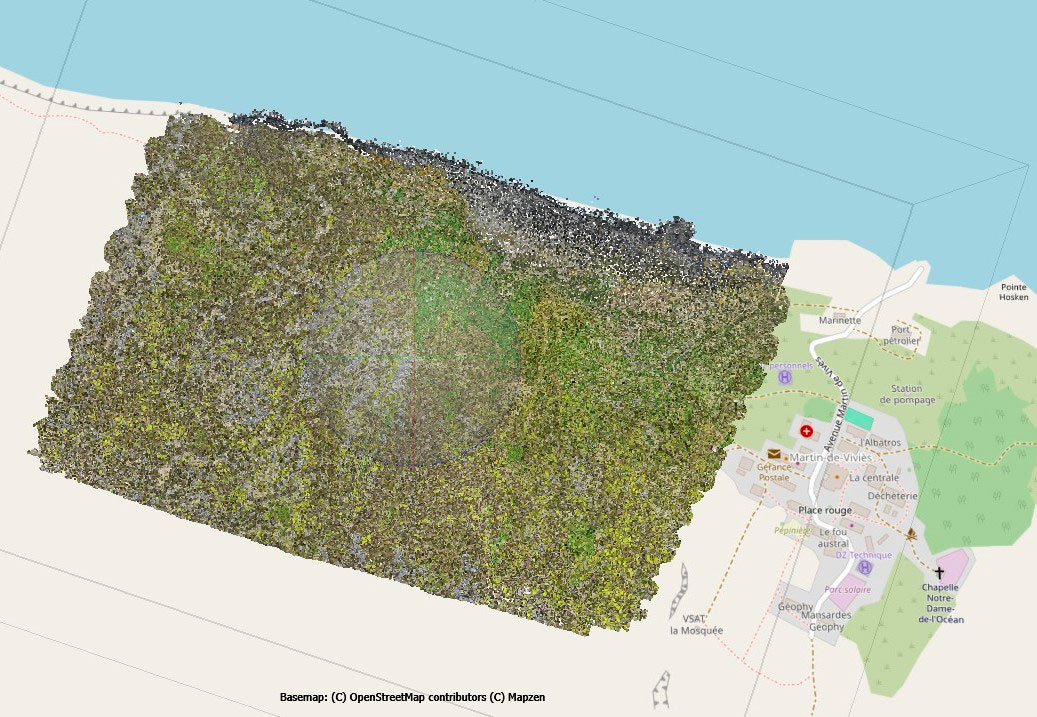
▲ Orthomosaic creation process following the drone mission to Elephant's Pool on Amsterdam Island. © CNRS, D. ESPEL, 2024 |
|
This work has taken on a special dimension since the fire in January 2025, which destroyed more than 50% of Amsterdam Island. Although it prevented the final floristic surveys from being carried out, the results remain solid and the maps produced will provide a vision of the 'before', which will be key to understanding the 'after' and guiding restoration efforts. |
▲ Pléiades Neo monitoring the evolution of the fire (December 2023 on the left vs. April 2025 on the right). As a result of a severe water deficit, and fueled by tall, dry grass, the fire mainly destroyed the island's low- and medium-altitude vegetation. The Martin-de-Viviès scientific base was evacuated but spared. © Airbus DS 2023, 2025 |

The shadow of rodents
A section of Cartovege2 was initially intended to support the RECI programme to eradicate rodents, which are introduced by man and seriously harmful to local and endemic species. Although the photo traps have not detected any individuals since 2022, their presence remains uncertain and two spraying campaigns were carried out in April and August 2024. "We asked for Pleiades images to be acquired before and after the spraying, but the fire blurred our view of the ecological impact after the spraying. However, our maps are still invaluable for monitoring changes in sensitive areas," says Diane.
Application on Saint-Paul
|
|
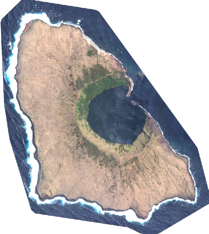
With its 8 km² dominated by a mineral zone that has earned it the nickname of the bat, the island of Saint-Paul is much smaller, with a more complex situation for the team: only 20 historical surveys exist when the field mission was not authorised... In a pragmatic logic, Diane wants to be reassuring: "we have archive photos, a good knowledge of the vegetation, very similar to that of Amsterdam, and a Pléiades Neo image received at the end of January 2025. We should be able to apply the model developed for Amsterdam".
◀︎ Saint-Paul island captured by Pléiades Neo. © Airbus DS, 2024 |
The home stretch
Cartovege2 is due to finish in January 2026. Between now and then, Diane Espel and her colleagues have a busy schedule, including transposing the data to St Paul and putting the processing pipeline and tutorial online. Scientific publications are also planned for 2025, including an article comparing the use of drones vs. satellite imagery, as well as the publication of the second Guide to the Natural Habitats of the Southern Territories, on Amsterdam, the first being devoted to Crozet*
* See the Guide to Natural Land Habitats on Crozet
👉 All this data will be capitalised in the national reference database on habitats HabRef, implemented by the Inventaire National du Patrimoine Naturel (INPN). The maps generated by the model will be integrated into the national habitat mapping platform developed as part of the CarHab programme.