SCOFrance
PartnersGlobEO, CNES, CESBIO
Useful linksTropiSCO.org
Key wordsDeforestation, near-real time, global, automatic
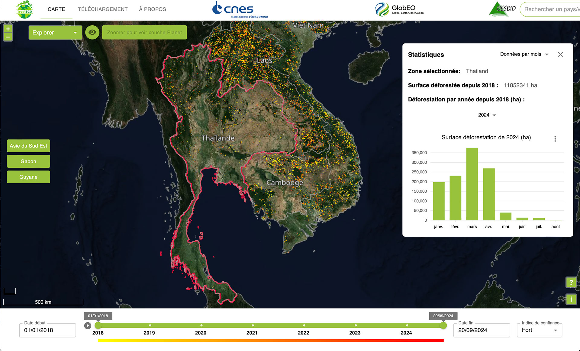
TropiSCO covers Thailand
|
Following on from the three areas already monitored in South-East Asia (Vietnam, Laos and Cambodia), TropiSCO now covers Thailand. In an area where there is no radar system, the tool meets a need expressed by the Thai space agency GISTDA (a signatory to the SCO Charter) to monitor deforestation throughout the country. "Thanks to the links we have forged with GISTDA over the last three years, they have agreed to share their forest mask. This mask is essential in our processing chain to make our deforestation detections usable and useful for them," explains Stéphane Mermoz, founder of GlobEO and designer of TropiSCO. |
Very rich in plant and animal biodiversity, Thailand lost around half of its forests between the 1960s and 2000, although the 1989 ban on logging (except for plantations) slowed this phenomenon. The country's forest cover is now estimated at 30%. The government is leading reforestation and conservation efforts, but challenges remain, such as illegal logging. |
With TropiSCO, Thailand will now be able to monitor the entire country, and particularly critical areas, with precise and reliable measurements. The next stage for TropiSCO: the Brazilian Amazon, by the end of 2024.
|
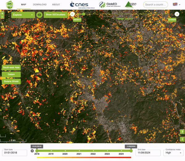
► Since the 2000s, Thailand has lost a significant proportion of its forests in the mountainous regions of the north (Chiang Mai and Nan provinces) to agricultural expansion, particularly visible on tropisco.org, and in the south (Surat Thani and Krabi) to palm oil and rubber plantations © TropiSCO |
|