Littoscope goes to scale with Corisclim
This was a major challenge, and LITTOSCOPE, a project from the first SCO Edition, rose to it with flying colors. Led by CLS, the project team delivered a web mapping platform that simulates marine submersions over different time horizons according to three scenarios of rising sea levels. By cross-referencing socio-economic data, these forecasts are accompanied by an assessment of the human, economic, heritage and environmental issues at stake. To achieve these results, the project focused on French pilot areas: the communes around the Palavas-Les-Flots pond on the Mediterranean coast and Gâvres on the Atlantic coast.
|
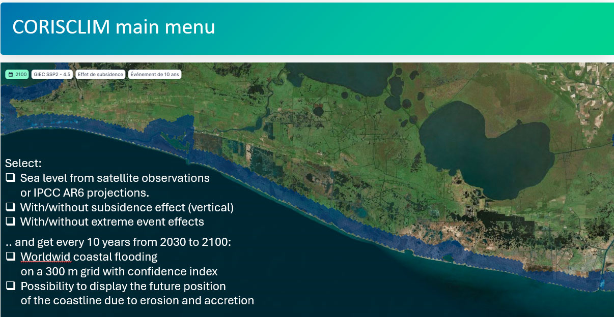
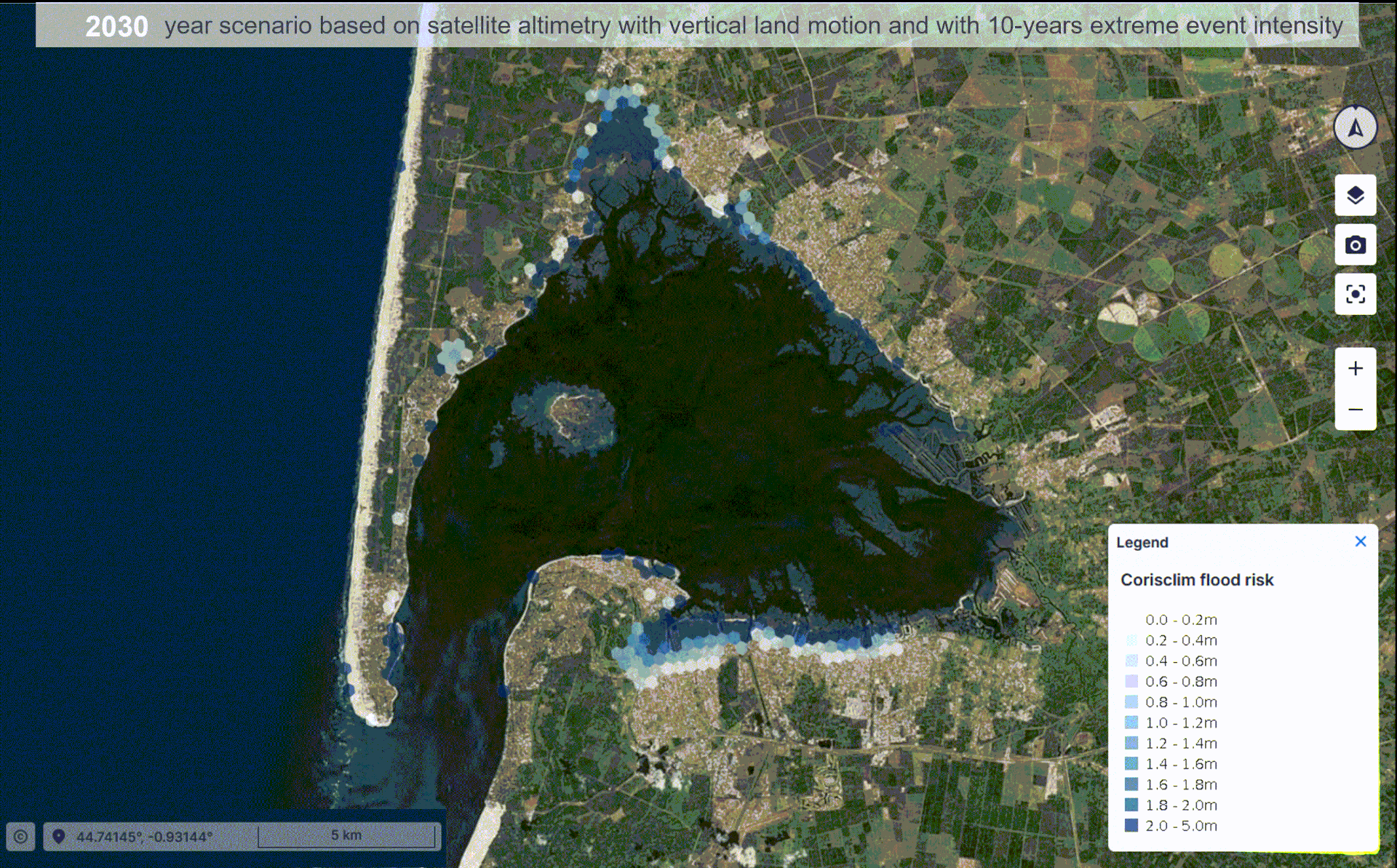
CLS is now taking CORISCLIM to the next level, adapting its method to provide a local estimate of coastal vulnerability on a global scale up to 2100, taking into account wave action and subsidence, and now offering a confidence index. Flexible enough to parameterize the specific characteristics of different coastlines (intensity of extreme waves, subsidence effects, etc.), the new interactive interface also offers the possibility of visualizing coastal erosion or accretion forecasts. |
CORISCLIM combines the use of several satellite systems: |
Service finalization
Produced within the ESA/BASS framework following a request from AXA Climate, a framework dedicated to the development of innovative space applications, this development is aimed at coastal authorities and coastal engineering offices, as well as insurance companies and development banks, NGOs, etc.
After a test phase during which the demonstration service remained freely available free on request, the feedback from pilot users will enable CORISCLIM to be optimized for an official launch at the end of 2024.
|
Find out more about CORISCLIM:
or |
© CLS |