

SCOFrance
PartnersFrance : Predict Services, Météo-France, Cerema, CNES
Haiti : DGPC, CNIGS, Ministry of Agriculture, ONQEV, Caribact, UHM
Useful linksProject page
Key wordsHydro-meteorological events, rainfall, flood zones, anticipation, warning, risk management
Gade Lapli: early warning for everyone
|
Hurricanes, floods, earthquakes, landslides, drought... Haiti has suf-fered one disaster after another: over 93% of its surface area and 96% of its population are exposed to the risk of at least two hazards [Source : ACP-UE NDRR]. The SCO Gade Lapli project has set up a platform for monitoring and warning of hydrometeorological events to help the public authorities, particularly the Directorate General for Civil Protection (DGPC). This is based on spatial data from the COSPARIN (COntribution du SPatial à l'Analyse du Risque INondation / Contribution of space to flood risk analysis) project. |
Why is Haiti so vulnerable? |
Advantages of the Gade Lapli platform
Developed by Predict Services, in partnership with a number of French and Haitian partners, the system operates at both local and national level.
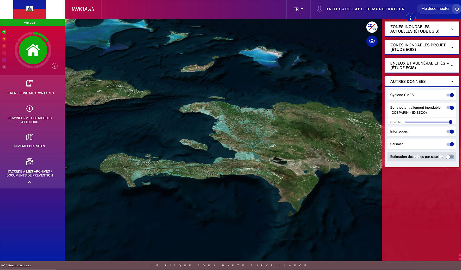
Accessible at all times via secure access, the platform is based on a central cartography (2D and 3D) with a vigilance indicator in the foreground. It thus provides a spatial display of information relating to hydrometeorological events in real time.
Anticipation and real-time monitoring
|
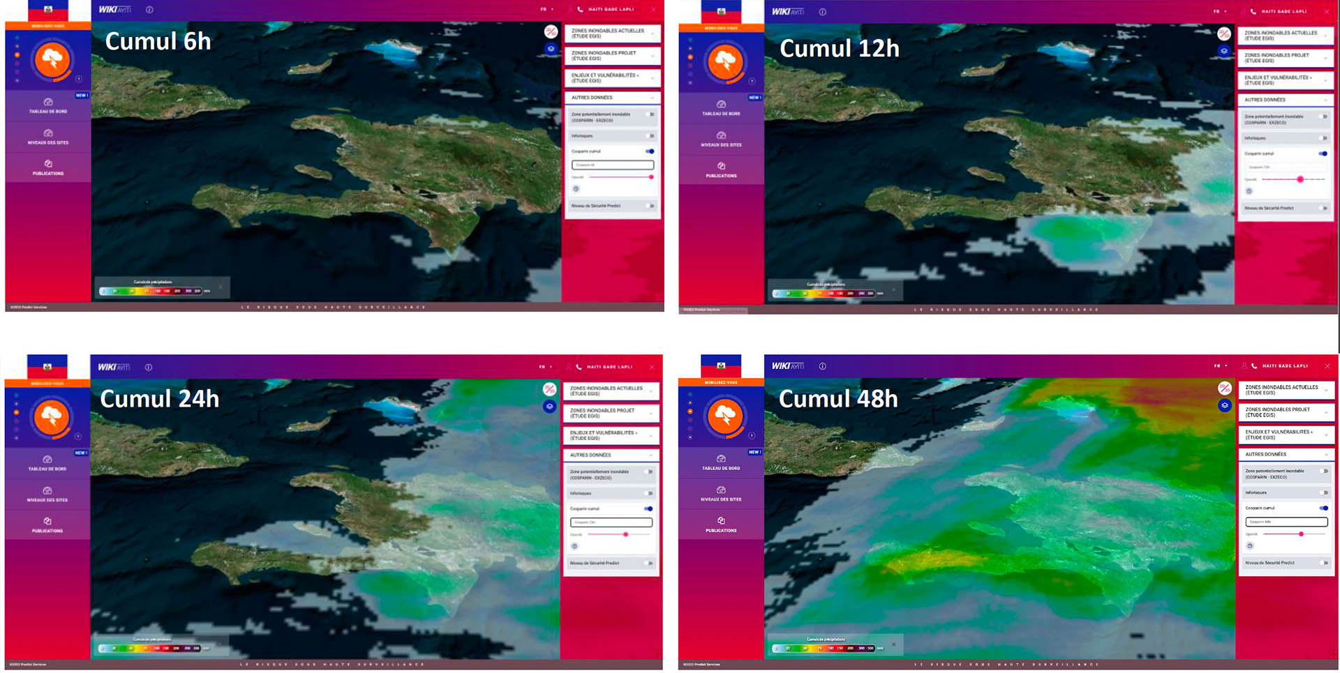
👉 Fed every 30 minutes with COSPARIN data, Gade Lapli calculates precipitation and rainfall totals in near real time.
►Cumulative rainfall. © Predict Services |
|
|
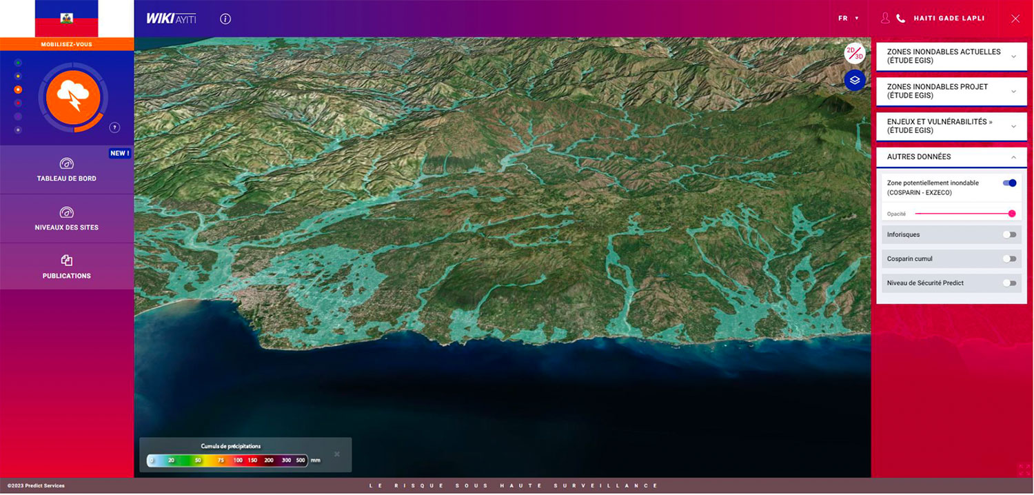
👉 Using Cerema's EXZECO method, the tool identifies and shows potentially flood-prone areas. Anticipated information covers the risks of flooding, marine submersion, cyclones and storms, as well as information relays for earthquakes, volcanic eruptions and tsunamis.
|
▲ Zoom in on areas potentially at risk of flooding during an orange alert, the level at which services need to be mobilised. © Predict Services |
Risk management assistance
The Gade Lapli platform generates daily risk anticipation bulletins (for the whole of the Caribbean) and provides information on the hydrometeorological situation in real time. Predict Services engineers send warning messages based on the phenomenon, its dynamics and the associated risks.
Taking into account all the phases of the risk, Gade Lapli generates post-event reports for immediate analysis of the situation. In addition to providing a panoramic view of the phenomenon and the damage caused, capitalizing on all these events enables relevant indicators and even trends to be identified.
👉View the results and their visuals
on the Gade Lapli project page
The user speaks
|
"We have used Gade Lapli in a very operational way," says Boby Emmanuel PIARD of the DGPC. "I remember the beginning of the project, and I can now say that satellite rainfall data is the best thing for our country, where we lack measuring stations, and therefore sufficient data to protect the population. We very much hope to be able to ensure the long-term future of the platform, both in terms of risk management and land-use planning. |
Between January 2022 and November 2023, the project monitored 2 earthquakes and 3 intense rainfall events with flooding, including tropical storm Francklin. At the time, the Gade Lapli system was in full development and enabled the DGPC to implement a number of information and prevention initiatives, inclu-ding the evacuation of over 1,800 households in anticipa-tion of intense rainfall in early June 2023, which turned out to be real, at the same time as a magnitude 4.9 earthquake. |