

Earth-WISE

Earth observation for monitoring the impact of climate change on Water surfaces in wildlife-livestock Interfaces in Southern African Environments
Overview
Context
The interface areas between protected areas and rural communal areas in southern Africa are conducive to wildlife-livestock interactions of varying frequency and intensity. Several studies have highlighted the importance of surface water as a key factor influencing the movements of wildlife and livestock, and the potential contacts that result, including the risks of pathogen transmission. As the availability of surface water in savannah environments is mainly determined by rainfall patterns, climate change in these regions has a direct impact on water surfaces and, consequently, on interactions between humans, domestic animals and wildlife.
➢ Methods for monitoring surface waters using Earth observation images are already operational, and a method combining remote sensing and spatial modelling has recently been developed to simulate animal movements (Rumiano et al., 2021, 2024). Applied to African buffalo (Syncerus caffer caffer) and domestic cattle (Bos taurus, Bos indicus), this model has been used to simulate herd movements and the location of contact zones, as well as their seasonal dynamics in space and time on the outskirts of three national parks in Zimbabwe and South Africa (Hwange, Kruger and Gonarezhou).
➢ In addition, an initial simple hydrological model was tested to simulate water surface dynamics based on rainfall and to assess the impact of different climate change scenarios on water availability in the Hwange region (Le Pioufle, 2022). This initial study highlighted the importance of taking into account practices (such as the installation of pumps) in order to gain a better understanding of the sustainability of water resources.
☞ Combined together, these two process-based models can be used to better understand and anticipate the impact of future changes (climate, landscape, practices, etc.) on wildlife-livestock contacts.
Objective and Methodology
The Earth-WISE project aims to develop an operational platform for monitoring water surfaces using satellite imagery, making it possible to simulate the impact of climate change on wildlife/livestock contacts and the associated risk of pathogen transmission.
To meet this objective, the project is structured around five main tasks:
- Hydrological modelling: development and validation of a water balance model to predict the dynamics of water surfaces based on rainfall.
- To characterize the species involved in wild-wild and wild-domestic interactions at watering points, (ii) to assess the intensity of the interactions and (iii) the risk of transmission of associated diseases such as foot-and-mouth disease in livestock or zoonotic diseases such as brucellosis or anthrax having an impact on the survival of wild populations.
- Scenario testing: combining the hydrological model and the animal mobility model to assess changes in interactions between wildlife and livestock as a function of different scenarios (climate change, changes in land use, practices, etc.).
- Dynamic mapping: development of a processing chain to map and characterize surface water, integration into an online platform with the results of scenario impact modelling. The platform specifications will be defined according to the needs identified by the partners and local stakeholders.
- Training and workshops: organization of workshops for end users in Zimbabwe.
- Coordination.
Application site(s)
|
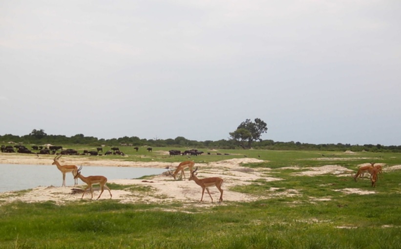
Hwange, Zimbabwe
► Photo traps deployed around water points in and around Hwange National Park, 2022 -2023. © HUM/ANI project |
|
Data
Satellite
- Sentinel-2
- Pléiades
- TAMSAT
Other
In-situ surveys of hydrological data
Results – Final product(s)
An online platform whose services will be defined with the end users: park and reserve staff, veterinary services, researchers and students from Zimbabwean universities.
This interface will provide, for example:
-
maps of water surfaces derived from Sentinel-2 images (spatial resolution of 10 metres, frequency to be defined).
-
maps of predicted water surfaces under different scenarios of climate change / changes in land use / practices (installation of pumps).
References
- Caron A., Rumiano F., Wielgus E., Miguel E., Tran A., Bah M.T., Grosbois V., De Garine-Wichatitsky M.. 2023. Characterization of buffalo/cattle interactions for assessing pathogen transmission. In : Caron Alexandre (ed.), Cornélis Daniel (ed.), Chardonnet Philippe (ed.), Prins Herbert H.T. (ed.). Ecology and management of the African buffalo. Cambridge : Cambridge University Press, p. 269-293. (Ecology, Biodiversity and Conservation). https://doi.org/10.1017/9781009006828.015
- Rumiano F., Miguel E., Dufleit V., Degenne P., Gaucherel C., Valls Fox H., De Garine-Wichatitsky M., Gandiwa E., Caron A., Tran A.. 2024. Spatial mechanistic modelling to simulate movements and contacts between wildlife and livestock in Southern Africa. Ecological Modelling, 498 : 15 p. https://doi.org/10.1016/j.ecolmodel.2024
- Rumiano F., Wielgus E., Miguel E., Chamaille-Jammes S., Valls H., Cornélis D., De Garine-Wichatitsky M., Fritz H., Caron A., Tran A. 2020. Remote sensing of environmental drivers influencing the movement ecology of sympatric wild and domestic ungulates in semi-arid savannas, a review. Remote Sensing, 12: 37 p. https://doi.org/10.3390/rs12193218
Related project(s)
- HUM-ANI
- RP-PCP, Research Platform Production and Conservation in Partnership
- Zone Atelier Hwange