Agricultural wasteland, discover the Izifriche solution
After 18 months' work, the SCO FrichesAgricoles project has succeeded in implementing a robust and innovative method for the automated and reliable pre-identification of agricultural wasteland. The result is the 1st mapping of agricultural wasteland in the 13 departments of Occitanie.
|
At a time when wasteland is a lever for adapting to climate change, ensuring food sovereignty and maintaining biodiversity, Izifriche is proving to be an essential solution for monitoring the development of these areas, planning their reclamation, implementing appropriate land strategies and meeting regulatory obligations in this area. |
|
Izifriche, a 3-in-1 solution
Designed to be as operational as possible, the Izifriche solution combines three complementary building blocks:
- an inventory of "WaSaBI wasteland", to be updated annually by cross-referencing vector data and automatic recognition using artificial intelligence (WaSaBI©CNES software),
- a mobile application for checking data in the field and training the WaSaBI software,
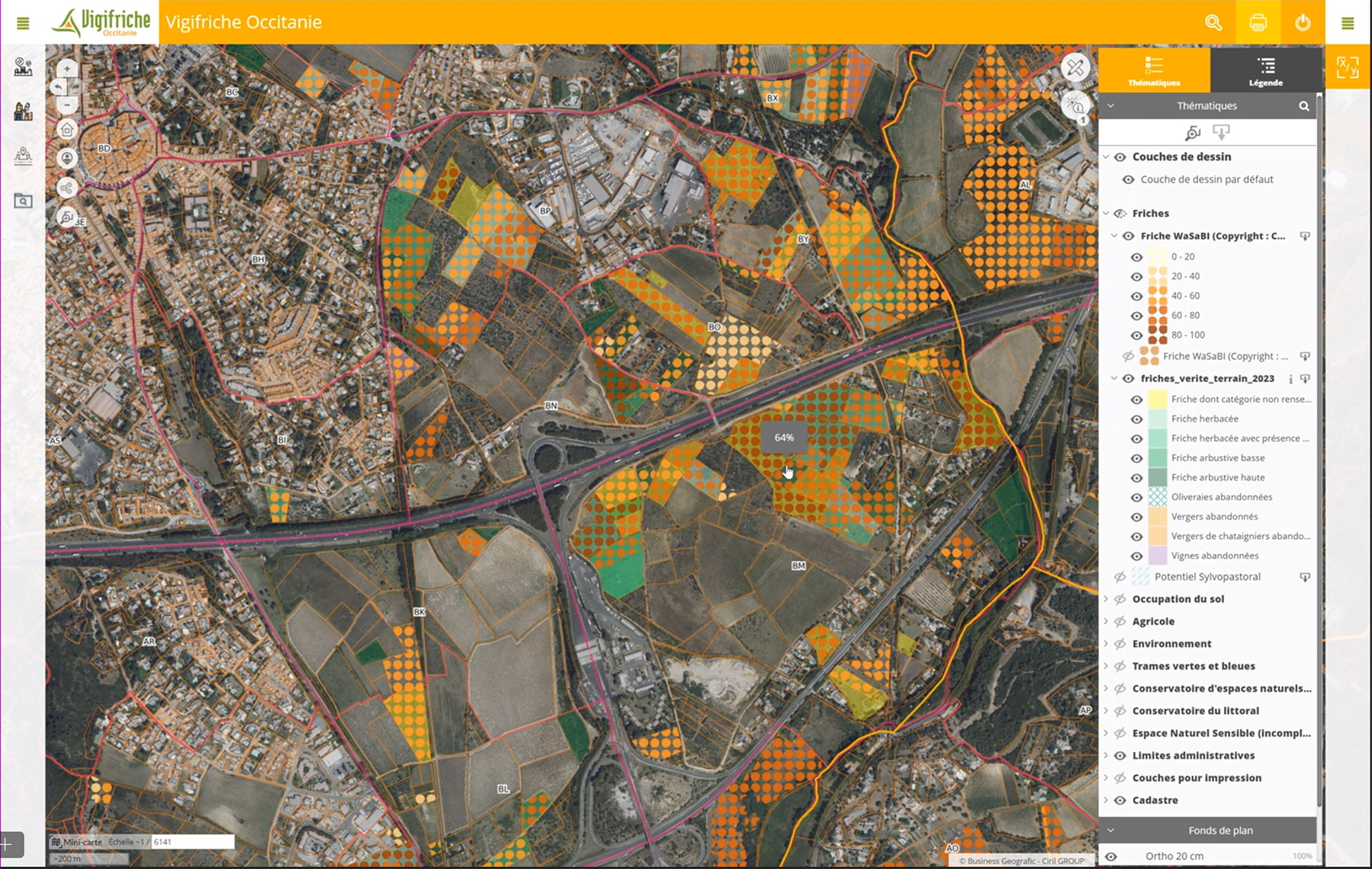
- a web interface giving access to around thirty geographical and technical data items, as well as a dozen or so functions for contextualising and summarising the issues at stake (wasteland files at plot, municipal, inter-municipal and department levels + WaSaBI wasteland reliability index).
Izifriche will be available on a subscription basis, at the level of local stakeholders' areas of competence, to help them define the best resilience strategies in response to agricultural decline.
👉 See details of the method and results on the project page
Outlook
In view of the quality of the results, the National Safer Federation would like to roll out a nationwide inventory of agricultural wasteland to support local players in the face of agricultural, environmental and climatic challenges.
Safer Occitanie will present the results of the SCO FrichesAgricoles and its operational prospects via Izifriche to the Occitania regional agricultural wasteland community (Communauté Régionale des Friches Agricoles d'Occitanie CRéFAO) on 26 April 2024.
"Izifriche is a tool to help identify wasteland and to support local authorities' land strategy in the face of agricultural, environmental and climate issues. The data (wasteland, geographical, technical and cadastral), the available functions (exports and queries) and the ergonomics of the tools were validated by a dozen local stakeholders during the project phase. The inventory will be updated annually to meet user expectations as effectively as possible. Isabelle Botrel, Director of the Territories, Planning and Environment Department at Safer Occitanie
|
© Safer Occitanie |
|
|


