

SCOFrance
More than 99%of French water reservoirs are not monitored
Useful linkProject page
Key wordsWater quality, small reservoirs, climate change
XtremQuality, space technology for detecting water quality
|
With a central role in preserving ecosystems and a source of conflicts of use, water resources are becoming a central element in the debates surrounding the ecological transition. In this context, the XtremQuality project, co-funded by the SCO and the Adour Garonne water agency, promises to be revolutionary. Led by the French Development Research Institute (IRD) and the Geosciences Environnement Toulouse (GET) laboratory, with the companies HETWA and Magellium, XTremQuality aims to provide a map of all water reservoirs in terms of their quantity and quality, based on a surface area of one hectare. These reservoirs may be hill reservoirs, gravel pits or natural or artificial lakes used for a variety of purposes. |
Less than 1% of French water reservoirs are monitored by the public authorities. Space technology can help fill this information gap by providing new information on the surface area of water in these reservoirs, as well as on their quality, based on variables that can be observed by satellite (turbidity of the water, presence of algae), which can be used to calculate vulnerability indices for water bodies and regions. |
Experiments in the French South-West
There are more than 6,000 lakes and reservoirs in the South-West region that cannot be monitored individually by field teams. The XTremQuality project aims to provide critical information on the state of these reservoirs in the context of climate change, particularly with regard to extreme events such as the severe low-water levels that are increasingly affecting the region.
|
In practice, the project will provide the surface area, turbidity and chlorophyll-a content of each body of water using Sentinel-2 satellite images. These data will be coupled with results from modelling and climate data to propose vulnerability indices. These indices will make it possible to identify how water in reservoirs deteriorates in the presence of severe low-water conditions, but also over several years (cumulative effect) and throughout the hydrological cycle. |
"By providing frequent maps, it becomes possible to better monitor the impact of drought events at the level of an individual lake, but also to deduce the state of the area upstream of each reservoir. The quality of the water drained by the soil in the local catchment into each reservoir provides information about soil erosion and nutrient loads, as well as irrigation practices and the presence of pollution". Jean-Michel Martinez, hydrology specialist for the IRD and project leader. |
The satellite data processing chain is currently being validated at the GET laboratory in order to integrate Sentinel-2 images at 20-metre resolution and provide maps of water surfaces with water quality indices, in particular the presence of microalgae based on estimated chlorophyll-a content. The main technical challenge is to extend the operation of the OBS2CO processing chain, available on the Hydroweb portal, to small bodies of water.
|
|
|
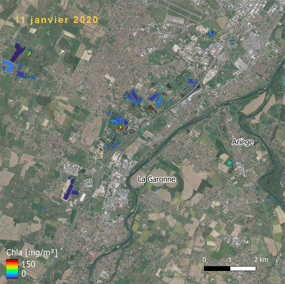
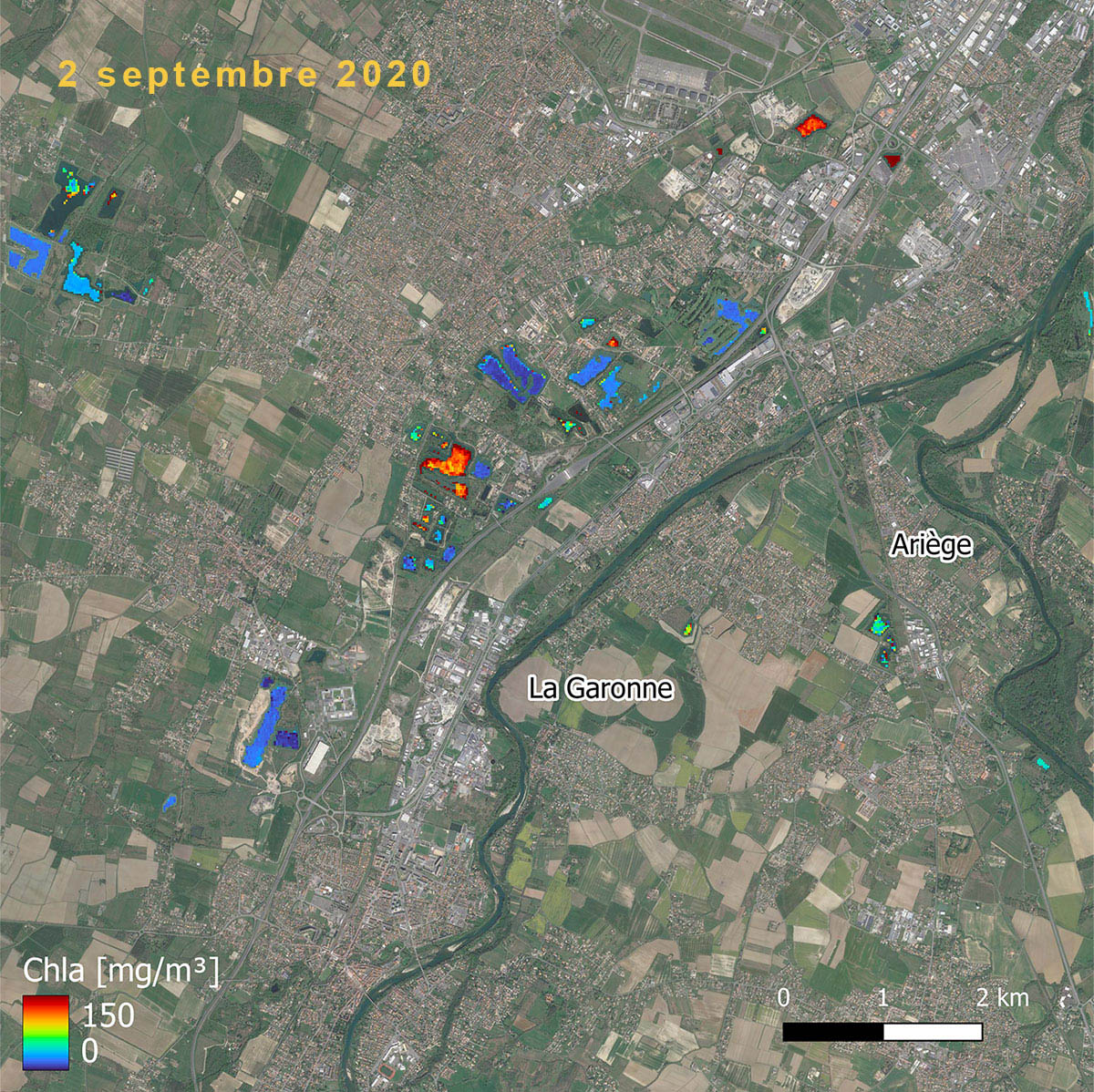
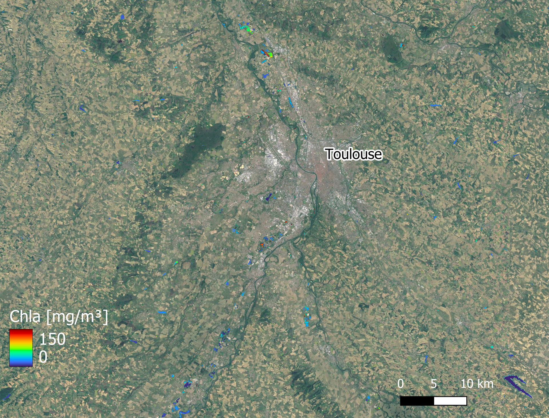
▲ Maps produced by the SCO XtremQuality project using Sentinel-2 images. These show the chlorophyll-a content, an indicator of the presence of algae, of gravel pit lakes and various reservoirs in the Toulouse region during the winter (left) and late summer (right) of 2020. We can see that the presence of algae varies from one lake to another and over time. These observations, repeated over time using satellite data, will be extended to the entire South-West region. © Copernicus Sentinel-2 Image / IRD processing
This unprecedented data, interpreted in conjunction with other environmental and climatic variables by the project team, will make it possible to deduce indices of vulnerability to climatic conditions such as drought.
On the strength of these advances, the partners are enthusiastic about the future. While HETWA, a specialist in environmental issues, is launching a thesis on the XtremQuality work, Magellium is preparing the design of the future interface.
Finally, while the project plans to cover the whole of south-west France, it also wants to transpose the system to a large agricultural region in Brazil, which is also facing the problem of water storage for agriculture in a context of more frequent droughts.