

SCOFrance
2/3of West Africa's coasts are highly vulnerable to climatic hazards
Useful links🎥 Project page
Key wordsWest African coast, sustainability, impact of sea level rise, coastal vulnerability, erosion, flooding, coastal resilience
WACA-VAR : two workshops and a publication

The interdisciplinary WACA-VAR project has been awarded the SCO label to develop the spatial component of the World Bank's West African coastal management programme, with 3 objectives:
- Produce new data from satellite imagery to better characterise coastal ecosystems,
- test the use of spatial data in coastal development projects,
- disseminate the results via a web-GIS platform to support public policy decision-making by coastal managers.
Scientific publication
On 9 January 2024, the WACA-VAR project team published the study "Coastal Vulnerability Assessment of the West African Coast to Flooding and Erosion" in the scientific journal Springer Nature.
Authors: Olusegun A. Dada1,2, Rafael Almar1* , Pierre Morand 3*
* : 1 LEGOS (IRD/CNRS/ CNES/Toulouse University), Toulouse, France;2 Dept of Marine Science & Tech, Federal University of Technology Akure, Akure, Nigeria;3 UMI SOURCE (IRD - UVSQ/PARIS SACLAY), Guyancourt, France.
Summary:
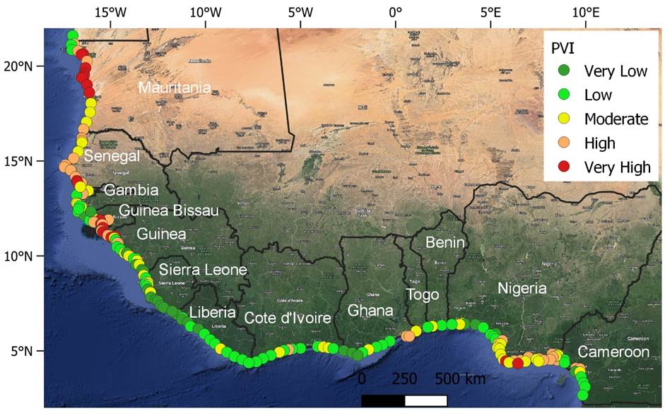
Global coastal areas are at risk due to geomorphological issues, climate change-induced sea-level rise, and increasing human population, settlements, and socioeconomic activities. Here, the study examines the vulnerability of the West African (WA) coast using six satellite-derived geophysical variables and two key socioeconomic parameters as indicators of coastal vulnerability index (CVI). These geophysical and socioeconomic variables are integrated to develop a CVI for the WA coast. Then, the regional hotspots of vulnerability with the main indicators that could influence how the WA coast behaves and can be managed are identified. The results indicate that 64, 17 and 19% of WA coastal areas had high to very high CVI, moderate CVI, and low to very low CVI, respectively. The study reveals that while geophysical variables contribute to coastal vulnerability in WA, socioeconomic factors, particularly high population growth and unsustainable human development at the coast, play a considerably larger role. Some sections of the WA coast are more vulnerable and exposed than others, particularly those in the region's northwestern and Gulf of Guinea regions. Climate change and human presence may amplify the vulnerability in these vulnerable areas in the future. Hence, future coastal economic development plans should be based on a deep understanding of local natural conditions, resource status, and geophysical parameters to prevent negative coastal ecosystem transformation. It is also essential to establish a coastal management plan that would facilitate the development of desired actions and stimulate sustainable management of West African coastal areas.
|
|
◀︎ Physical Vulnerability Index (PVI) for West Africa (The map image used to produce the figure was generated using the Google Satellite Hybrid plugin in the QGIS v.3.24.0 environment). |
Two conferences to exchange ideas
On 4 and 5 December 2023 in Douala and from 6 to 8 December in Kribi, the 1st International Conference on "Vulnerabilities, Surveillance and Coastal Area Management (VUSAC)" and the 3rd Workshop on "West and central African Coastal Areas - mapping Vulnerability, Adaptability and Resilience in a changing climate (WACA-VAR)" were held.
International organizations, researchers, professionals, students and public decision-makers... More than a hundred participants came together with the common aim of mapping the vulnerability of coastal zones in Central and West Africa and popularizing the results of research into the management, planning and development of these zones.
Various oral presentations and posters focused on issues relating to biodiversity and its preservation, the sustainability and vulnerability of coastal zones to erosion and flooding, and the economics and vulnerability of fisheries. Recommendations were also made to local decision-makers and managers for better coastal zone planning. In addition, participants were able to take part in 5 training sessions on the use of new tools. The next editions will be held in Côte d'Ivoire in 2025.
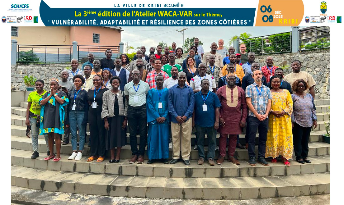
▲ Family photo at the start of the WACA-VAR 2023 Workshop in Kribi, Cameroon. © IRD