

SCOFrance
46Natural habitat types
Useful links🎥 Cartove1 presentation
Key wordsSouthern Territories, vegetation, habitats, cartography, typology, preservation
Transition for Cartovege
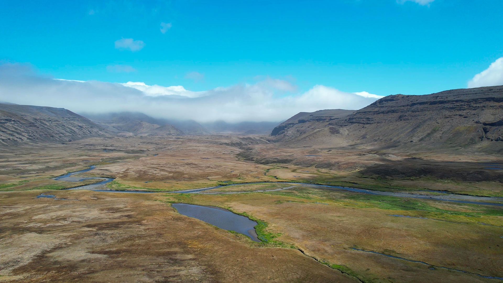
At around 46° South, barely 2,000 km from the coast of the South Pole, the French Southern Territories remain a sanctuary of biodiversity. The SCO Cartovege project aims to improve our knowledge of these environments, so that we can better protect them and restore the natural balances disrupted by mankind and climate change.
|
Now operational on the Crozet & Kerguelen archipelagos, its tool offers cartographic modeling of habitats specific to the Southern Territories, particularly useful for some of their islands that are inaccessible to man. Replicable, the solution is already being transposed to the neighbouring islands of Saint-Paul and Amsterdam as part of a second phase, Cartovege2. While the program has been developed in close collaboration with the French Southern Territories National Nature Reserve (RNN TAF), the tool's main user, it is also aimed at scientists (botanists, ornithologists, etc.) and managers of areas with very similar vegetation and the same issues.
Let's get to the heart of the matter with the results of Cartovege1 and the launch of Cartovege2. |
The user's voice: "collective intelligence in the process |
Cartovege 1 : objectives achieved
Implemented on the Crozet & Kerguelen archipelago, the Cartovege project has masterfully laid the foundations for an operational habitat monitoring tool:
- Definition of a typology of natural habitats and their conservation challenges
The absence of a common and comprehensive typology for the Austral Islands has long been an obstacle to the implementation of coordinated research and targeted, appropriate conservation actions. This was the very first stage of the project which, thanks to the banking of over 2,000 field data, the knowledge of the RNN TAF and members of the Polar Institute's 136-SUBANTECO project, was able to establish a typology of 46 habitat types grouped into 4 environments: coastal, wet (the most diverse), mesic vegetated (on well-drained slopes) and non-coastal mineral (high, wind-exposed areas).
👉 This typology will be integrated into the HabRef national habitat database during 2024, and is the subject of the first volume of the Guide to the terrestrial habitats of the French Southern Territories (Guide des habitats terrestres des Terres Australes Françaises). Describing in detail the habitats surveyed and the keys to their identification, this work is intended as a real support for field agents and is currently being published.
- Development of a semi-automatic method for mapping habitats at very high resolution to ensure consistent monitoring
|
Through a major programming effort, the Cartovege team has developed a multi-source ecological and imagery data processing chain to create a habitat model using supervised classification to automatically generate a habitat map.
▶︎ Conceptual diagram of the mapping tool developed on the island of La Possession, Crozet archipelago. |
|
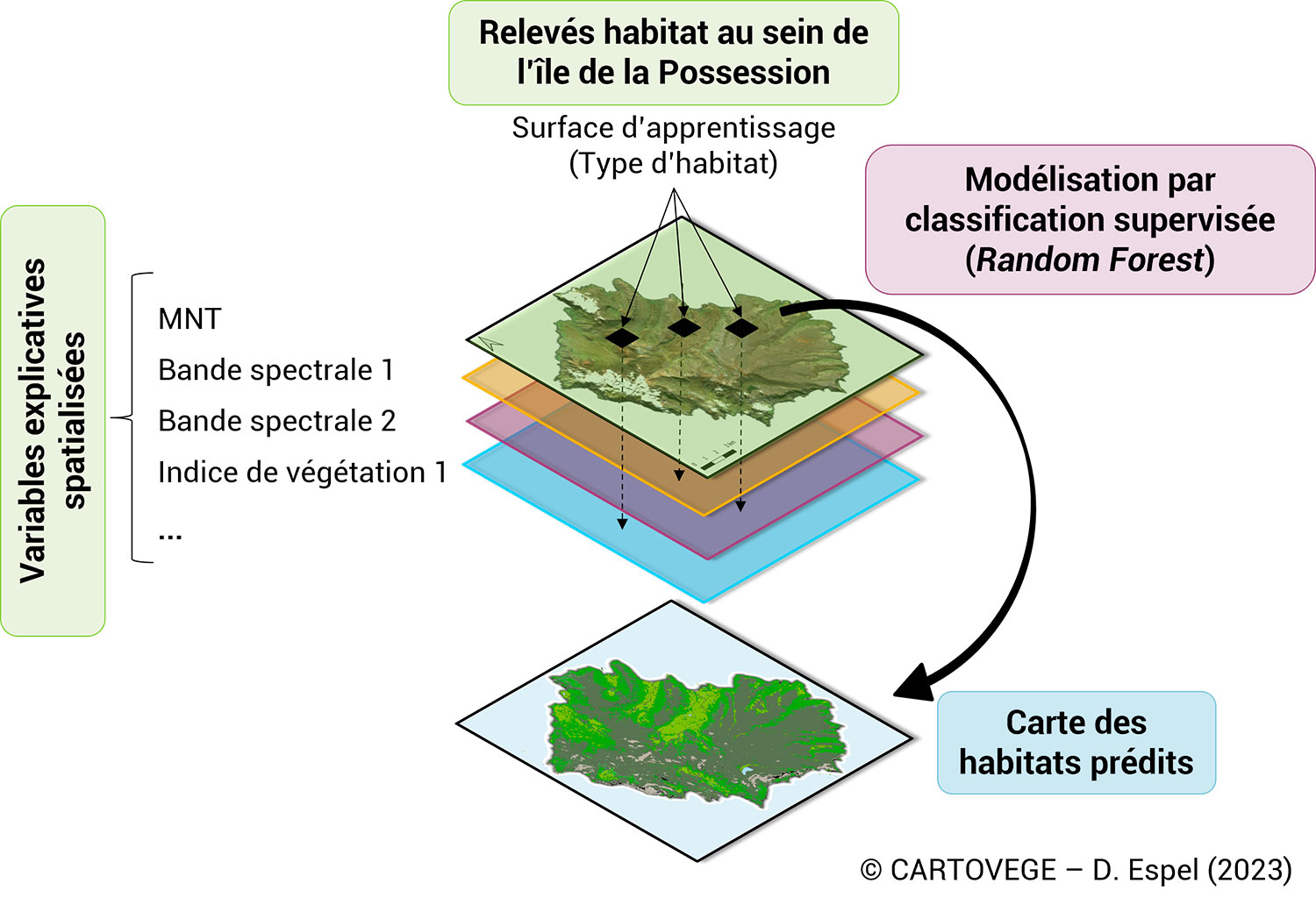
👉Open source on GitHub and accompanied by tutorials, the tool and its processing chain are adaptable, reproducible and transposable.
- Spatial habitat modeling
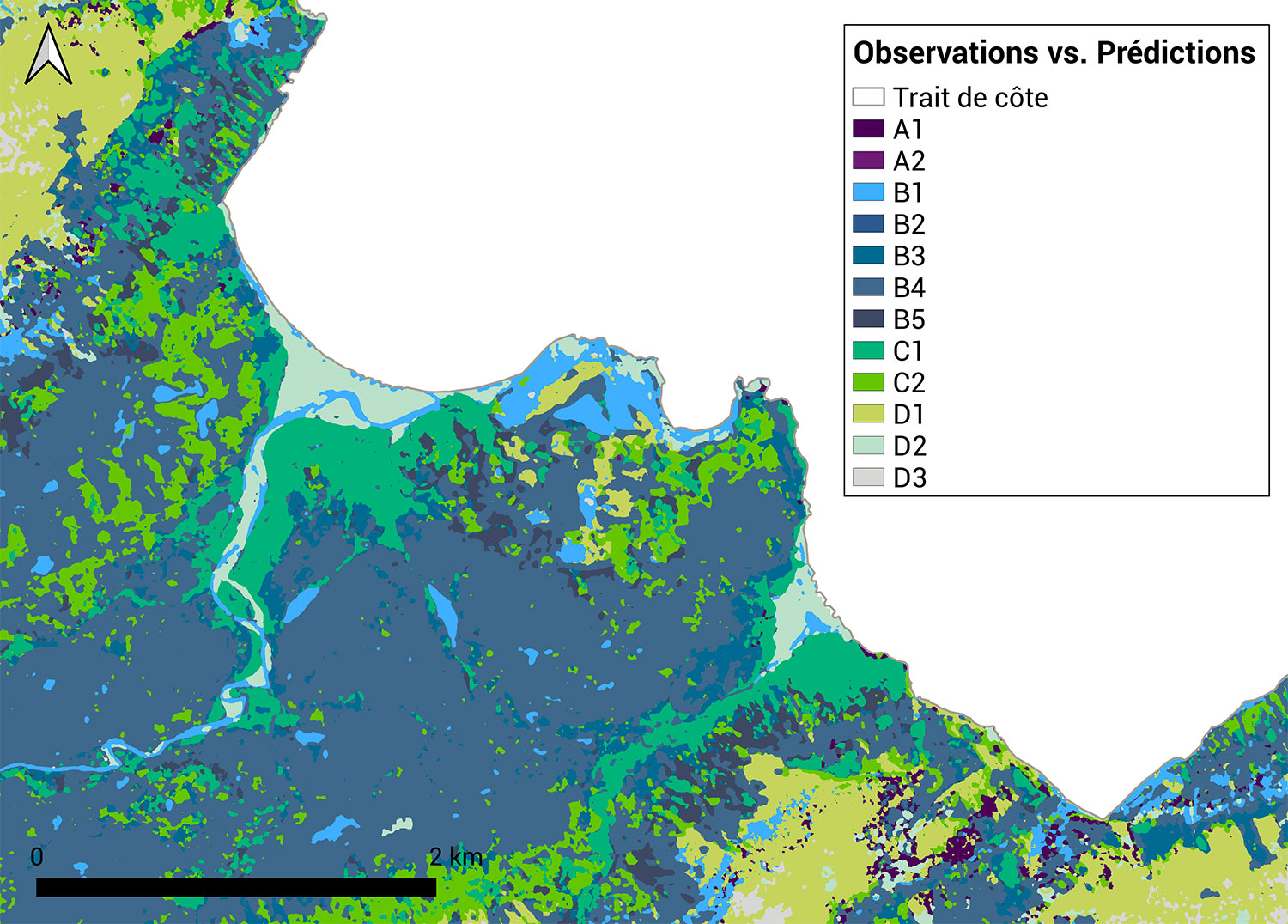
Using the previously developed pipeline, the Cartovege team set out to develop a predictive habitat model for areas where no data had previously been available. To do this, it once again uses spatial data (Pleiades multispectral and DTM from NASA's Shuttle Radar Topography Mission (SRTM) satellites), from which it extracts seven terrain explanatory variables (topography, vegetation, humidity, bare soil, etc.). To verify the accuracy of the habitat distribution maps thus produced, the project established an aerial drone-monitoring protocol which enabled 34 orthomosaics to be produced over specific areas (i.e. 4% of Possession Island) at sub-centimeter resolution (read the news item on the use of the drone).
|
👉 Habitat maps with 12 classes predicted at 0.5 m resolution are validated. Beyond 12 classes, the prediction error rate increases, but the causes have been identified, and the team is working to resolve them. 👉 Commitment to openness and sharing, the habitat maps will be available during 2024 on the Carhab visualization portal. A scientific publication of the results is also planned for 2024. |
▲ Predicted Crozet habitat map (12 predicted classes) at 50 cm resolution: zoom on the American Bay on the island of La Possession. Classes A include coastal environments, B wetlands, C mesic vegetated environments and D mineral environments with little or no vegetation. |
See detailed results and method on the project page
Benefits of SCO certification
According to the Cartovege team, the SCO label has been a decisive factor in federating a community of scientists and managers, enabling them to co-construct tools that meet their needs. The SCO also helped us to benefit from the support of data and hosting infrastructures (Dinamis, CNRS, UMS Patrinat, OFB...) and to give visibility to the project.
Heading for Cartovege2
With the same set of players and partners, Cartovege2 will transpose its approach to the islands of Saint-Paul and Amsterdam to define the typology of habitats and then produce semi-automatic mapping of plant formations. Images have already been acquired, and the team intends to take advantage of this step to integrate the shrub layer (texture) and a better DTM thanks to Pleiades tri-stereoscopy.
The first approach of its kind on a global scale, Cartovege2 will assess the effects of introduced and invasive species on native biodiversity. As part of the RECI project, led by RNN TAF, a cat and rodent eradication campaign scheduled for spring 2024 on Amsterdam Island will provide an opportunity for real-time monitoring of these impacts and the resilience of communities following their removal.
Finally, all this work will feed into predictive modelling to anticipate habitat dynamics according to different climatic and management scenarios.
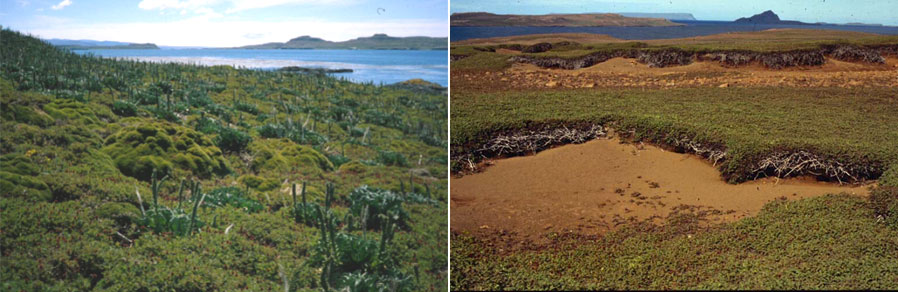
▲ In Kerguelen, native plant communities (left, Mayès Islands) are strongly affected by the presence of rabbits (right, Isthme Bas). © Institut polaire français, 136-Subanteco
See a detailed presentation of the Cartovege project2
French Southern and Antarctic Lands: Paradox between science and carbon impacts
To be totally consistent, the project decided to estimate its carbon footprint for Cartovege1 based on figures from the French Territorial climate-air-energy plan, currently being finalized for the TAAF. The result is disastrous, with an equivalent of 117 tonnes of CO2, mainly due to travel (by plane and, above all, by the TAAF supply ship, the Marion Dufresne).
A sobering figure. However, thanks to these tools, which are now operational scientists and managers will no longer need to go out into the field: a revisit to update the model every 5 years will reduce this carbon footprint by 56%, and even by 96% if no more visits are made.