

SCOFrance
400Plant species studied
Useful linksProject page
GreenCity website
Key wordsUrban vegetation, urban trees, nature in city, air pollution, ozone, fine particles, future climate, recommendations
GreenSpace: choose carefully trees species
Project monitoring meetings are always a great opportunity to better know the teams and learn more about the issues covered, with a few surprises thrown in for good measure! Like with GreenSpace, where we learned - among other things - that certain trees can significantly degrade air quality. 🧐
Project objectives
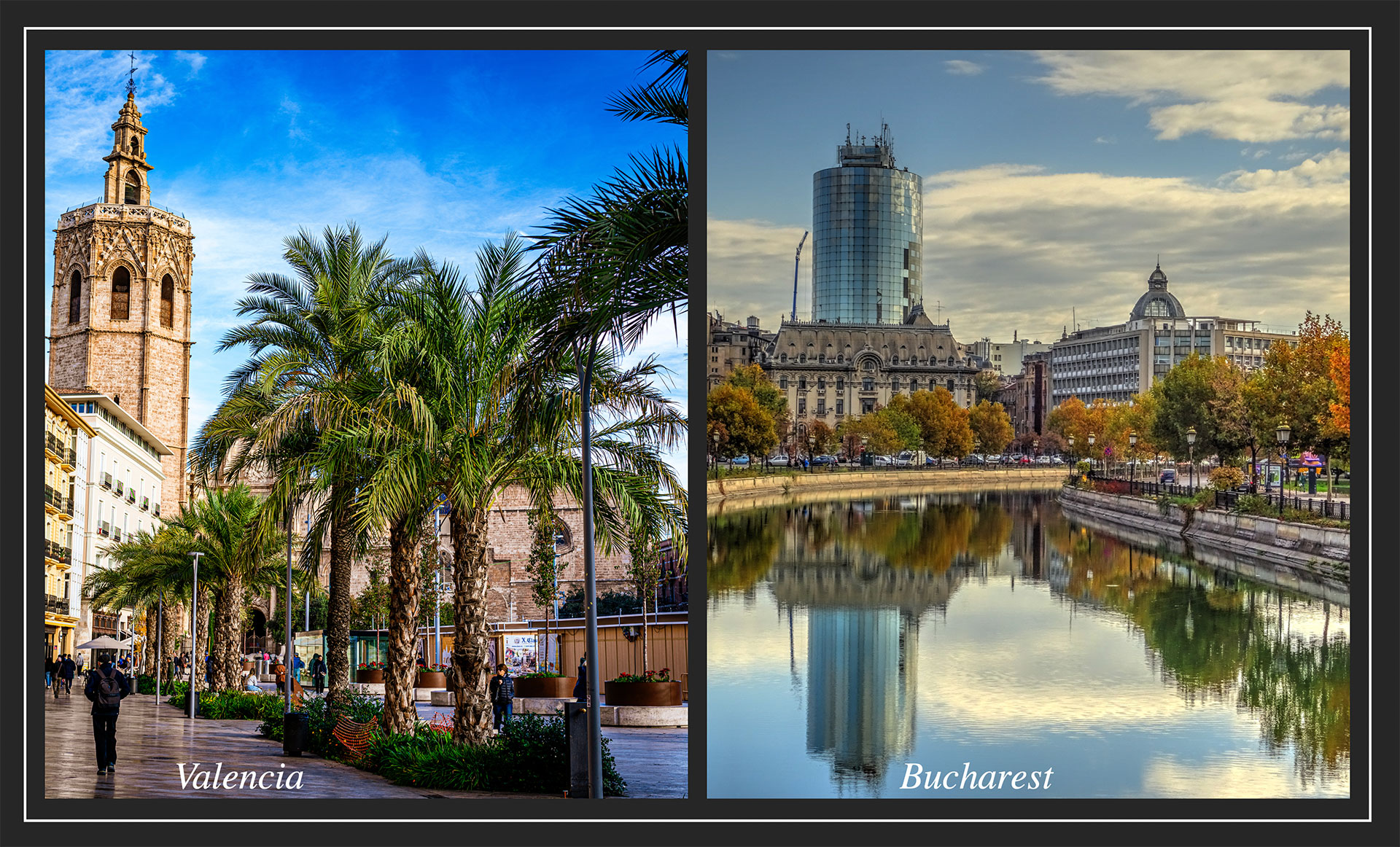
The fruit of a dozen years of scientific research, GreenSpace is prototyping its final services in two cities with very different characteristics: Valencia, in Spain, which is particularly affected by ozone pollution, and Bucharest, in Romania, where fine-particle pollution is a major health issue.
Developed by ARGANS, the service is aimed directly at towns and cities that need indicators to help them respond to new French and European environmental policies, but also to project their future climate. Typically, according to the IPCC's most optimistic scenario, by 2050 the cities in south-eastern France will experience the same climate that Valencia today. In this context, identifying the tree species that are profitable today in Valencia can prove to be excellent advice for establishing a (re)vegetation strategy for the French towns and cities in Provence-Alpes-Côte d'Azur region.
Two new services
Conducted in 4 stages, the method begins and ends with two major innovations.
- Complete satellite inventory of public and private green spaces
Would you believe that, on average 80 to 85% of urban trees are privately owned? In this context, the private sphere plays a major role in the urban greening strategies.
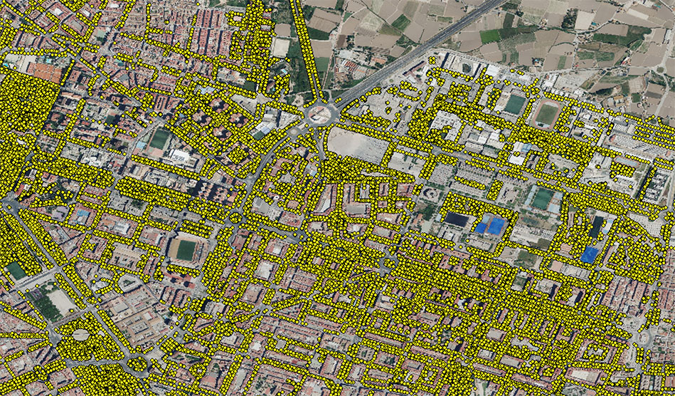
👉 The public trees inventory, i.e. managed by the municipality, serves as a training database for subsequently identifying the private stock on satellite images.
- Realistic quantification of the capacity of trees to reduce (or not) air pollution and sequester CO2at city scale, thanks to this complete inventory and scientific knowledge of the different species.
-
Mapping of urban heat islands and sensitive areas to target and define greening strategies.
- Production of recommendations such as the number and choice of tree species for planting policies.
|
It was this aspect that left the audience speechless! As Pierre Sicard, an expert in air pollution and urban forestry from ARGANS, put it, "All trees are good for people, but not necessarily for air quality. While all trees eliminate particulate and gaseous pollutants from their immediate environment, some species emit volatile organic compounds which, under the effect of solar radiation, combine with other pollutants to generate so-called secondary pollutants such as ozone. Ultimately, depending on their numbers and climatic conditions, some trees can produce more pollutants than they eliminate". |
Ozone is the 3rd greenhouse gas which, through the photochemical phenomenon (accentuated by rising temperatures), becomes a pollutant. Already emitted in large quantities by car exhausts, ozone in cities is becoming a major problem. |
👉 In Valencia, for example, which is very rich in palm trees, GreenSpace recommends, among other things, planting species such as the maple, which can offset the ozone formation generated by palm trees.
👉 In a city like Bucharest, other species will be recommended for their ability to eliminate fine particles emitted mainly by road traffic.
"An effective urban greening strategy must take account of global warming and air pollution, with the right selection of species in relation to those that already exist.” Pierre Sicard, ARGANS
Project progress
Using an agile approach to co-build the system with users, the project team began by meeting with the two partner cities at the end of 2023.
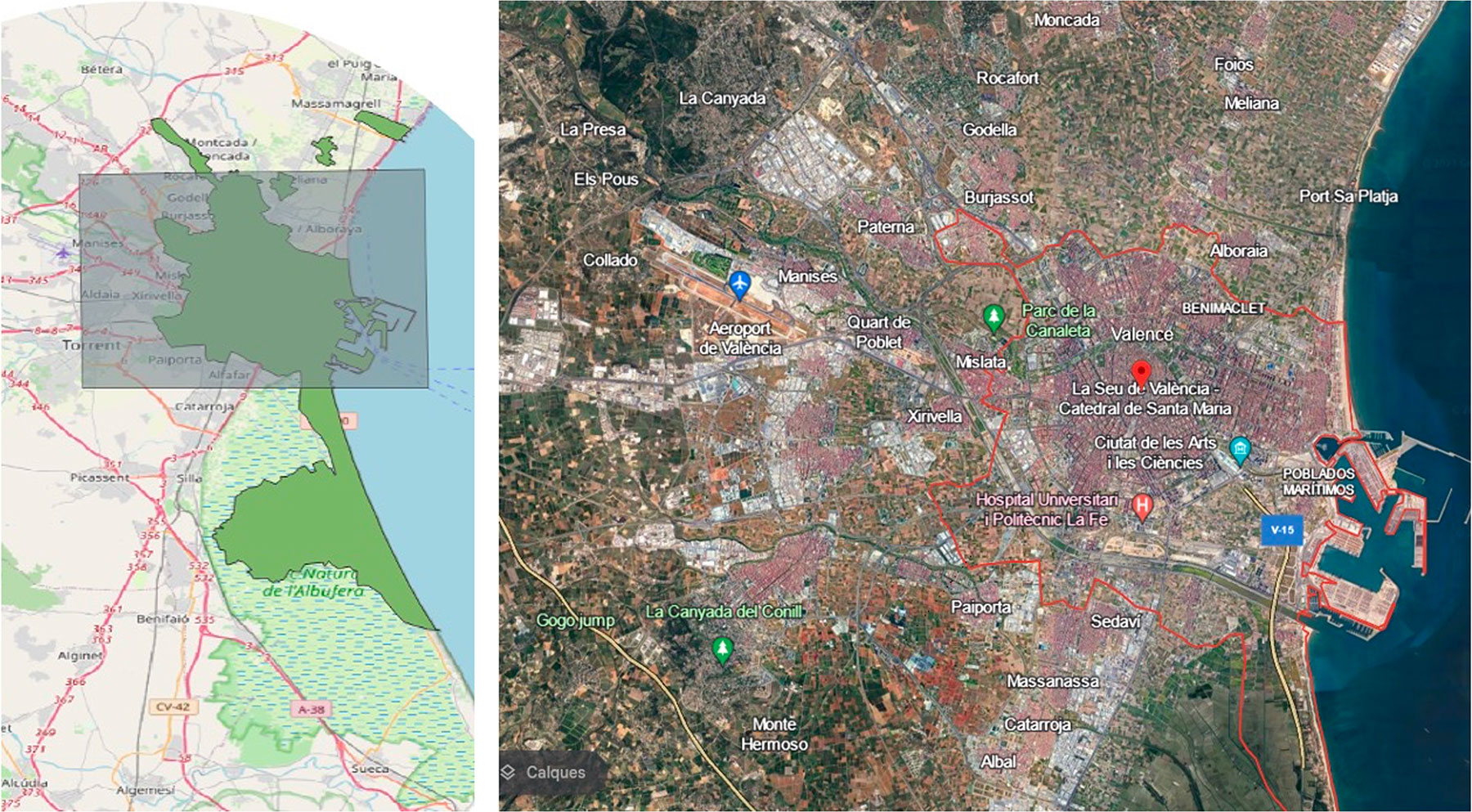
Valencia: the study area and requirements have been defined, the municipal tree inventory provided, and the first multispectral satellite images acquired. The team is now starting to carry out a spectral analysis of these images to detect and classify the trees, using tri-stereoscopy to define their height. A field validation campaign is planned in June, which is the best period to characterize the vegetation. The project team will be able to focus on mapping the services provided (filtering pollution and greenhouse gases, carbon storage).
|
Valence study area. © ARGANS |
Mapping of public trees. © ARGANS |
|
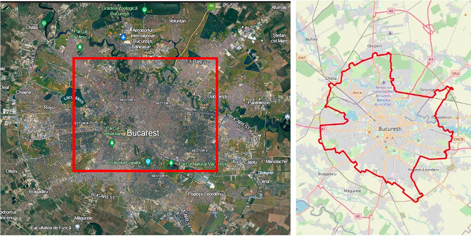
Bucharest: extended (251 km2), the study area has been defined. The other stages are underway, with the need to request Pleiades programming in June so that spectral analysis can begin in July 2024. |
Bucharest study area. © ARGANS |
In preparation for its future results display interface, ARGANS is currently integrating the GreenCity website.